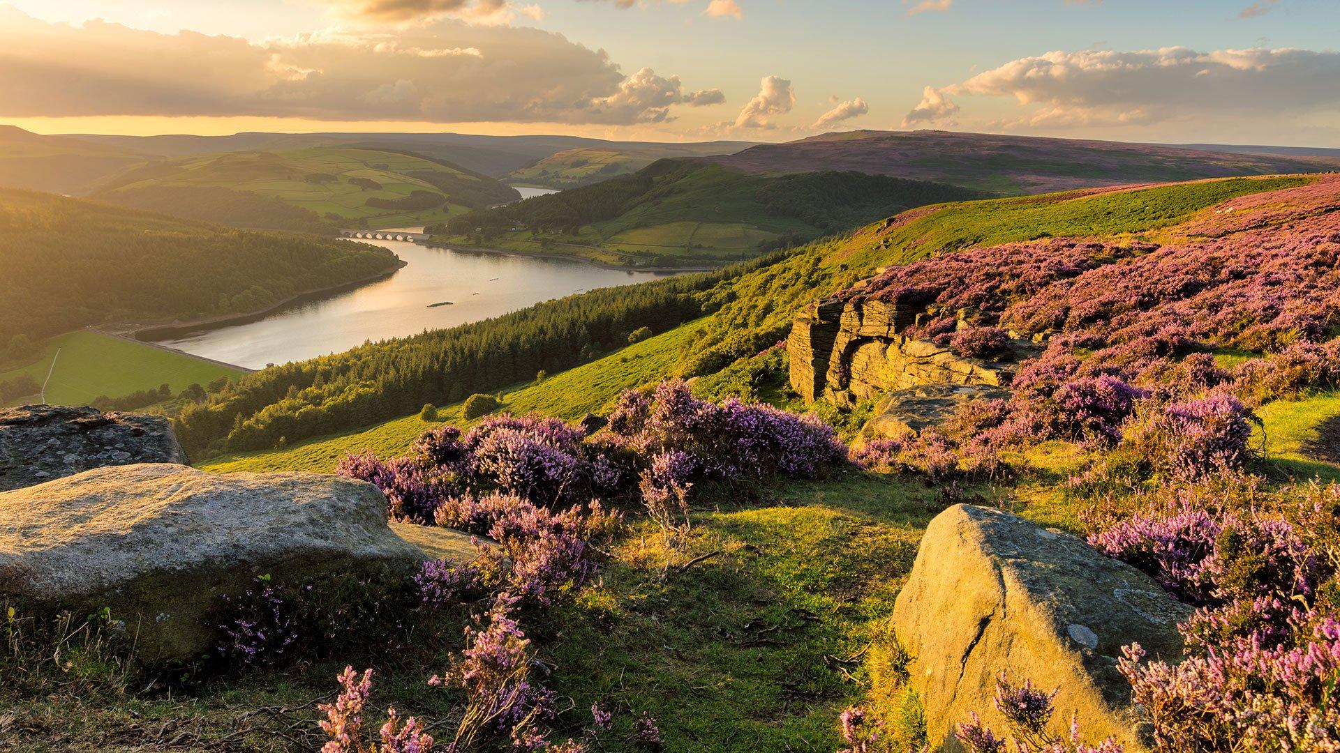
Recommended Routes: The Peak District
We believe there is no better way to explore Great Britain than on foot or bike. To prove that point, we’ve teamed up with Ordnance Survey, the national mapping agency, to share the best routes they recommend in Great Britain.
In this guide we set our sights on the paths and trails which mark out the The Peak District National Park as an adventure’s paradise. We’ve split the routes into categories i.e. lake, hill, mountain, with grade levels (Easy, Moderate, Challenging, Mountain). You'll also find the Ordnance Survey map you’ll need; plus, you can explore the route virtually using the recorded ‘Fly Through Videos’. Use the Navigation below to select Moor or Hill routes.
A Quick Guide to Exploring Britain Responsibly
- Check and follow the latest Government guidelines for England, Scotland & Wales
- Plan ahead
- Take the right gear
- If it feels too busy, consider another option
- Read our simple Guide to Map Reading with Ordnance Survey & Knowing Your Compass
Moor
Hill
Recommended Routes in The Peak District
So lace up your walking boots, pack your snacks and join us as we explore the best routes for walkers, cyclists and families in The Peak District.
Moor
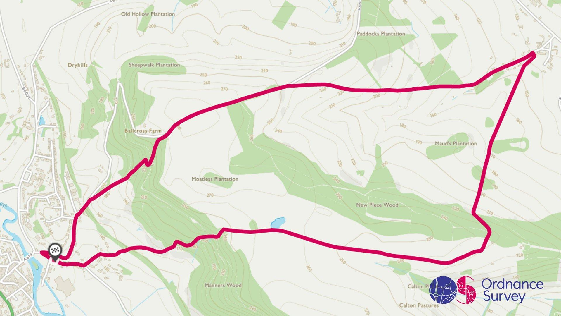
Bakewell Circular Walk
Grade: Moderate
Terrain: Countryside
Distance: 7.8km | Approx. Time: 2:00 – 2:30 hours
Ordnance Survey Map: Explorer OL24
Ordnance Survey Digital Map Here.
This leisurely walk from Bakewell town centre, taking in New Pierce Wood and Chatsworth Park, is a great example of how quickly you can escape the hustle and bustle of a town, straight into to the tranquil countryside. After leaving the Tourist Information Centre, take in the luscious trees and interesting landscape that makes up New Pierce Wood and meander through the Neolithic earth works by Calton Pastures. Don’t forget to catch a glimpse of stately home Chatsworth House, if you have time, take a detour around the beautiful Chatsworth Park. After circling back via Edensor, the final resting place of the Dukes of Devonshire, head back towards Bakewell and as a reward pick up a well-earned Bakewell Pudding from one of the many outlets that lay claim to the famous baked treat.
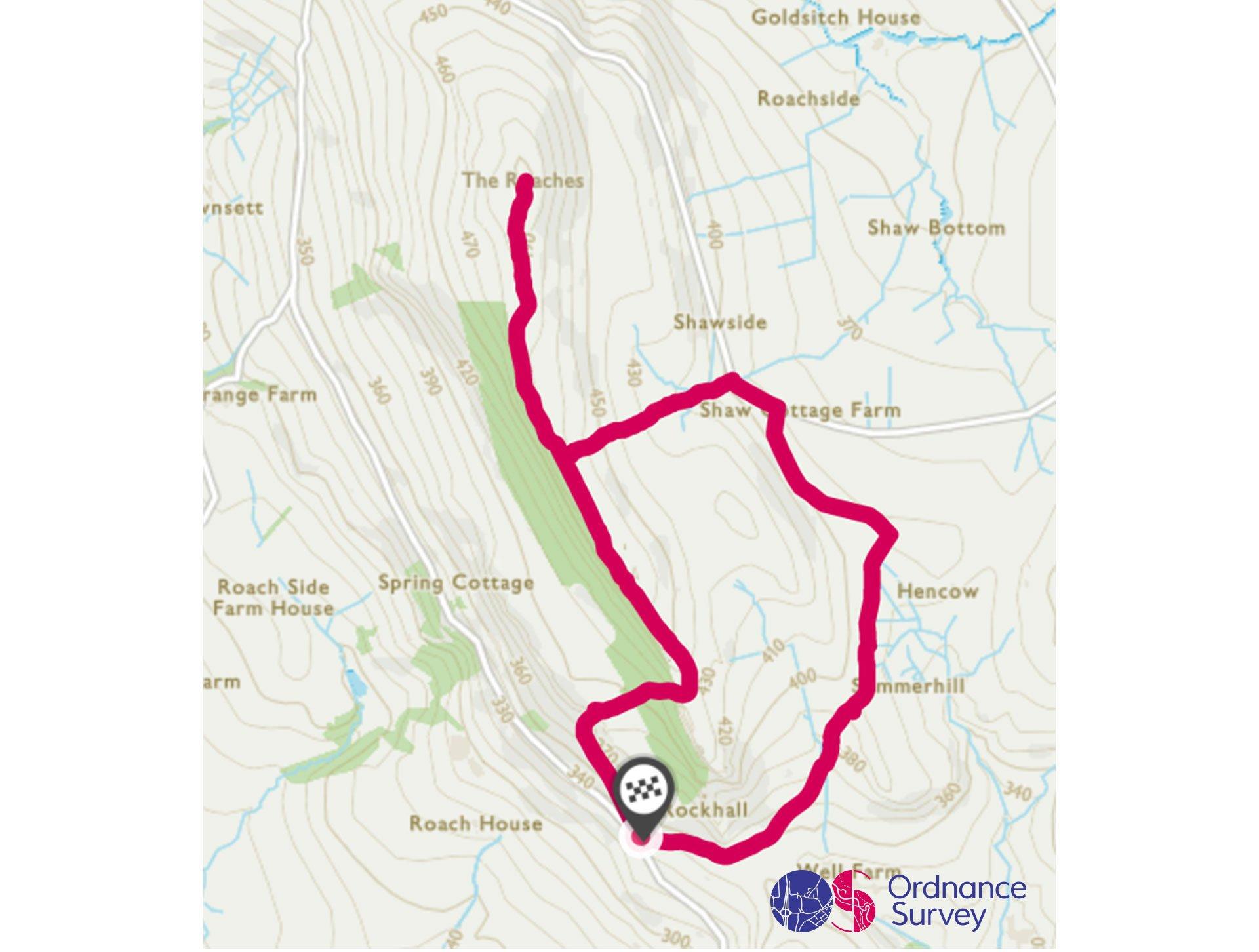
The Roaches Circular Walk
Grade: Easy
Terrain: Countryside
Distance: 5.7km | Approx. Time: 1:30 hours
Ordnance Survey Map: Explorer OL24
Ordnance Survey Digital Map Here.
This iconic location in the Peak District, is a perfect spot for a morning stroll before visiting nearby Leek for a spot of lunch. The Roaches, a gritstone rock formation that rises 500m high, boasts on a clear day views of Cheshire and even Snowdon in Wales. Along the route you will come across Doxley Pool which according to legend is home to Jenny Green teeth, a mythical water spirit that lurks below the pond surface.
Hill
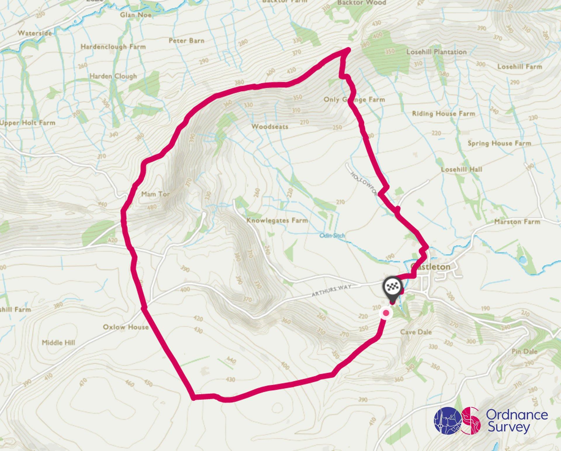
Mam Tor Circular Walk
Grade: Moderate
Terrain: Countryside
Distance: 9km | Approx. Time: 2:30 hours
Ordnance Survey Map: Explorer OL1
Ordnance Survey Digital Map Here.
Mam Tor, the Shivering Mountain, is one of the more dramatic hills in the Peak District. Made of unstable shale rocks, it gets its name from the regular landslips that happen on its slopes, eventually leading to the abandonment of the road that crossed its flanks. The ridge from there is one of the finest in Derbyshire, with expansive views over Edale to the north. The village of Castleton is a popular attraction in its own right, with ancient Peveril Castle, several spectacular show caves, and plenty of places to get some refreshments after your walk.
Add the paper map detailed in the route to your collection with 40% off all Ordnance Survey maps. Need help with your map reading? Read our Map Reading with Ordnance Survey guide.
The Peak District is made for adventure. So where will you explore first? Share your snaps and tag us in your adventures using #mymillets.