We believe there is no better way to explore Great Britain than on foot or bike. To prove that point, we’ve teamed up with Ordnance Survey, the national mapping agency, to share the best routes they recommend in Great Britain.
In this guide we lace up ready to explore the paths and trails which wind their way through Yorkshire and its National Parks including the North York Moors and the Yorkshire Dales. We’ve split the routes into categories i.e. lake, hill, mountain, with grade levels (Easy, Moderate, Challenging, Mountain). You'll also find the Ordnance Survey map you’ll need; plus, you can explore the route virtually using the recorded ‘Fly Through Videos’. Use the Navigation below to select Countryside or Valley routes.
A Quick Guide to Exploring Britain Responsibly
- Check and follow the latest Government guidelines for England, Scotland & Wales
- Plan ahead
- Take the right gear
- If it feels too busy, consider another option
- Read our simple Guide to Map Reading with Ordnance Survey & Knowing Your Compass
Countryside
Valley
Recommended Routes in Yorkshire
So lace up your walking boots, pack your snacks and join us as we explore the best routes for walkers, cyclists and families in Yorkshire.
Countryside
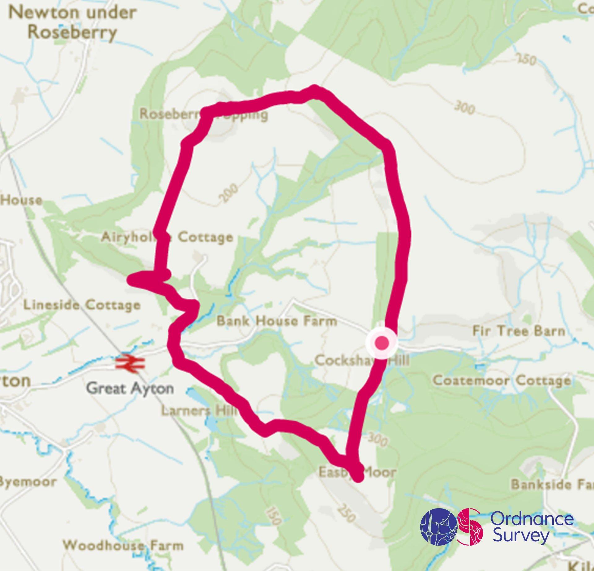
Malham Cove
Grade: Moderate
Terrain: Countryside
Distance: 6.2km | Approx. Time: 1:45 hours
Ordnance Survey Map: Explorer OL27
Ordnance Survey Digital Map Here.
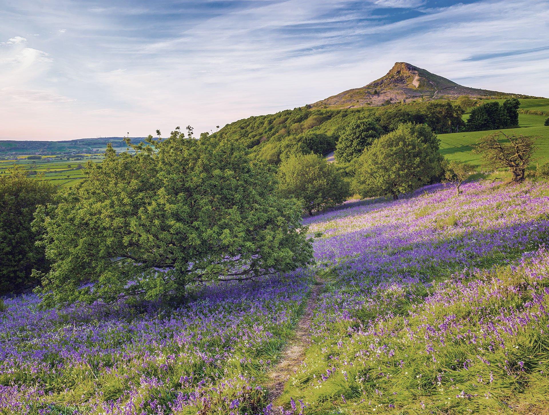
Malham Cove is well-known beauty spot in the Yorkshire Dales, formed after the last ice age from a glacial waterfall, it is a perfect spot for a morning stroll starting from Malham Village. After leaving the car park you will pass Malham Beck before reaching the stunning limestone amphitheatre featured in Harry Potter and the Deathly Hallows. Slowly ascending the side of the cove, once you reach the top, you will be treated to picturesque views of the rolling Dales countryside. As you make your way back round through woodland, it’s not long until you are back in Malham for a spot of lunch or well-earned ice-cream.
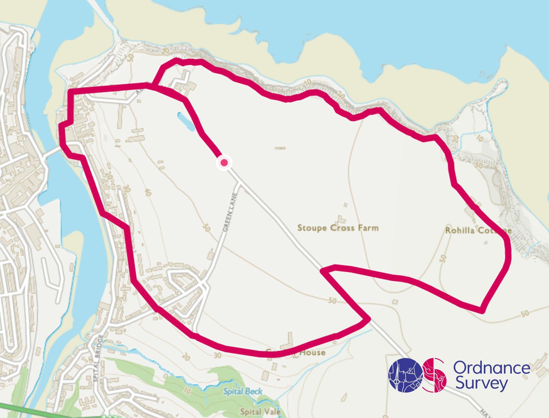
Brimham Rocks, Nidderdale
Grade: Moderate
Terrain: Countryside/Valley
Distance:7.4km | Approx. Time: 2:00 hours
Ordnance Survey Map: Explorer OL26
Ordnance Survey Digital Map Here.
Rocks shaped like a turtle or even a smartie tube? That’s what you will discover on this leisurely walk around Brimham Rocks and the surrounding area. Formed from the erosion of sandstone over millions of years, and so unique are the shapes, that it was widely thought the rocks were carved by druids. Heading up from the car park you will be able to wander around the rock formations and drop into the visitor centre to find out more, before heading out across the Nidderdale Area of Outstanding Beauty.
Valley
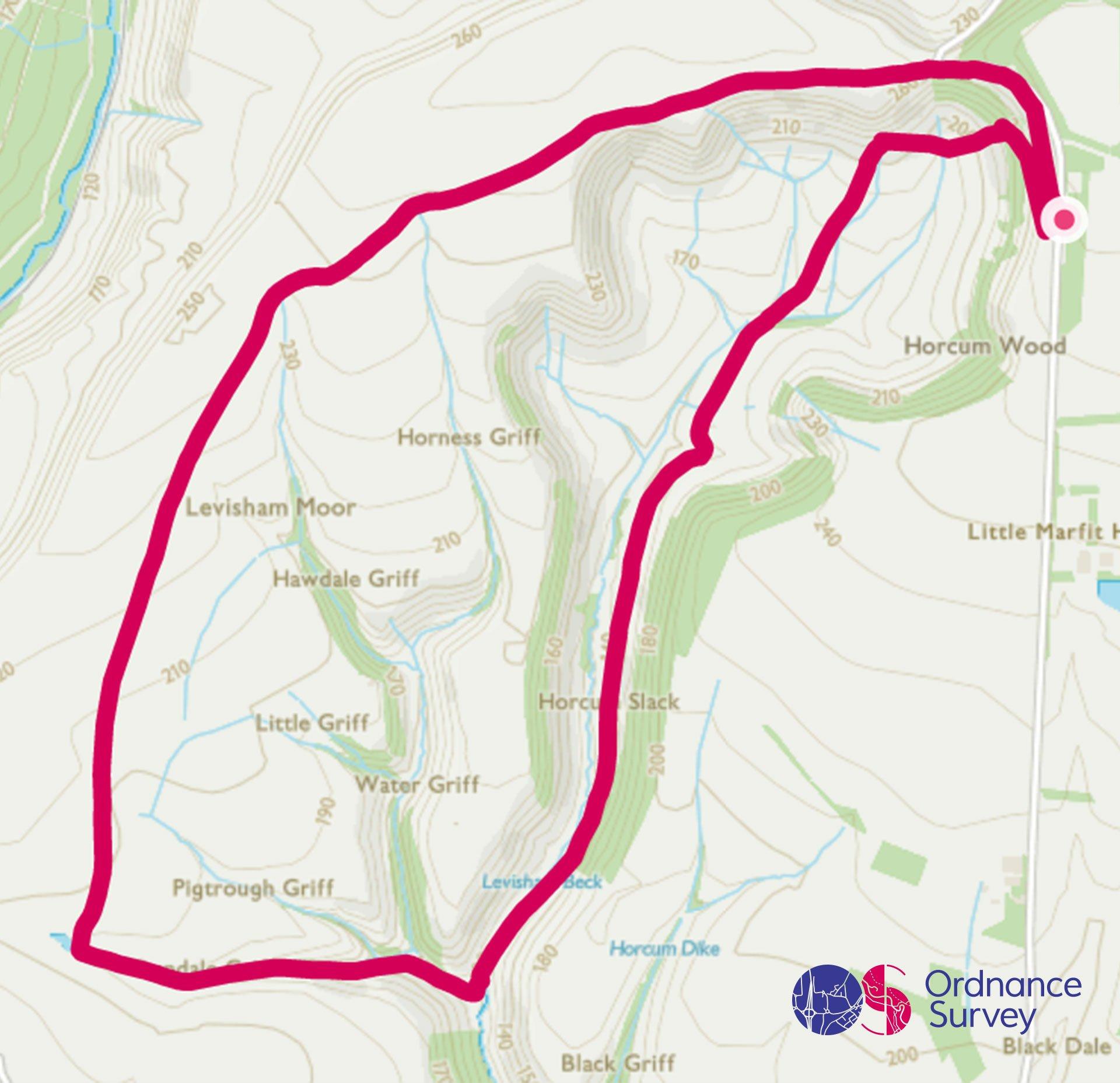
Brontë Waterfall, Haworth
Grade: Moderate
Terrain: Valley
Distance: 9.5km | Approx. Time: 2.00 - 2:30 hours
Ordnance Survey Map: Explorer OL27
Ordnance Survey Digital Map Here.
Take a step into literary history and follow the footstep of the famous Brontë Family, on this walk around ‘Brontë country’. Starting off from Penistone Hill Country Park, you will see the impressive moors that surround Haworth, as you head up to the beautiful Brontë Waterfall.
Add the paper map detailed in the route to your collection with 40% off all Ordnance Survey maps. Need help with your map reading? Read our Map Reading with Ordnance Survey guide.
Yorkshire is made for adventure. So where will you explore first? Share your snaps and tag us in your adventures using #mymillets.