Recommended Routes: North York Moors
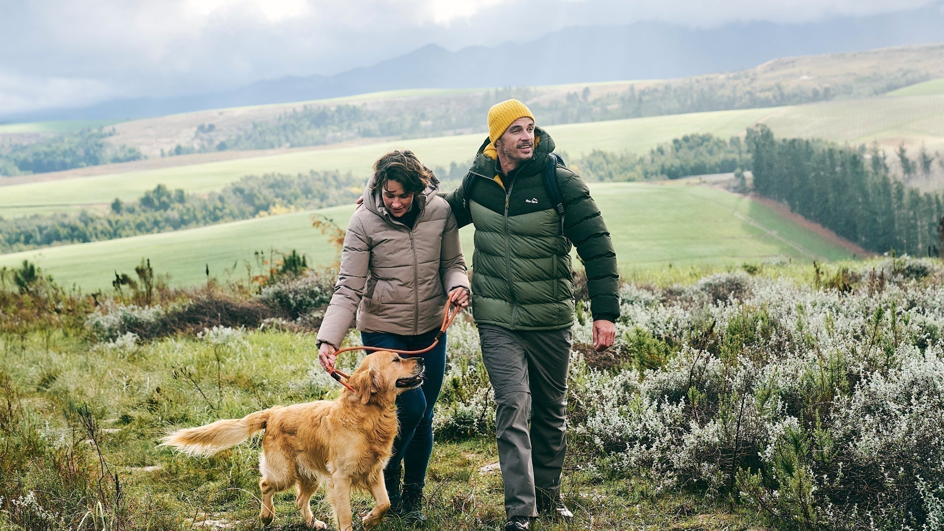
We believe there is no better way to explore Great Britain than on foot or bike. To prove that point, we’ve teamed up with Ordnance Survey, the national mapping agency, to share the best routes they recommend in Great Britain.
In this guide we set our sights on the paths and trails which mark out the North York Moors National Park as an adventure’s playground. We’ve split the routes into categories i.e. lake, hill, mountain, with grade levels (Easy, Moderate, Challenging, Mountain). You'll also find the Ordnance Survey map you’ll need; plus, you can explore the route virtually using the recorded ‘Fly Through Videos’. Use the Navigation below to select Coast or Countryside routes.
A Quick Guide to Exploring Britain Responsibly
- Check and follow the latest Government guidelines for England, Scotland & Wales
- Plan ahead
- Take the right gear
- If it feels too busy, consider another option
- Read our simple Guide to Map Reading with Ordnance Survey & Knowing Your Compass
Coast
Countryside
Recommended Routes in the North York Moors
So lace up your walking boots, pack your snacks and join us as we explore the best routes for walkers, cyclists and families in the North York Moors.
Coast
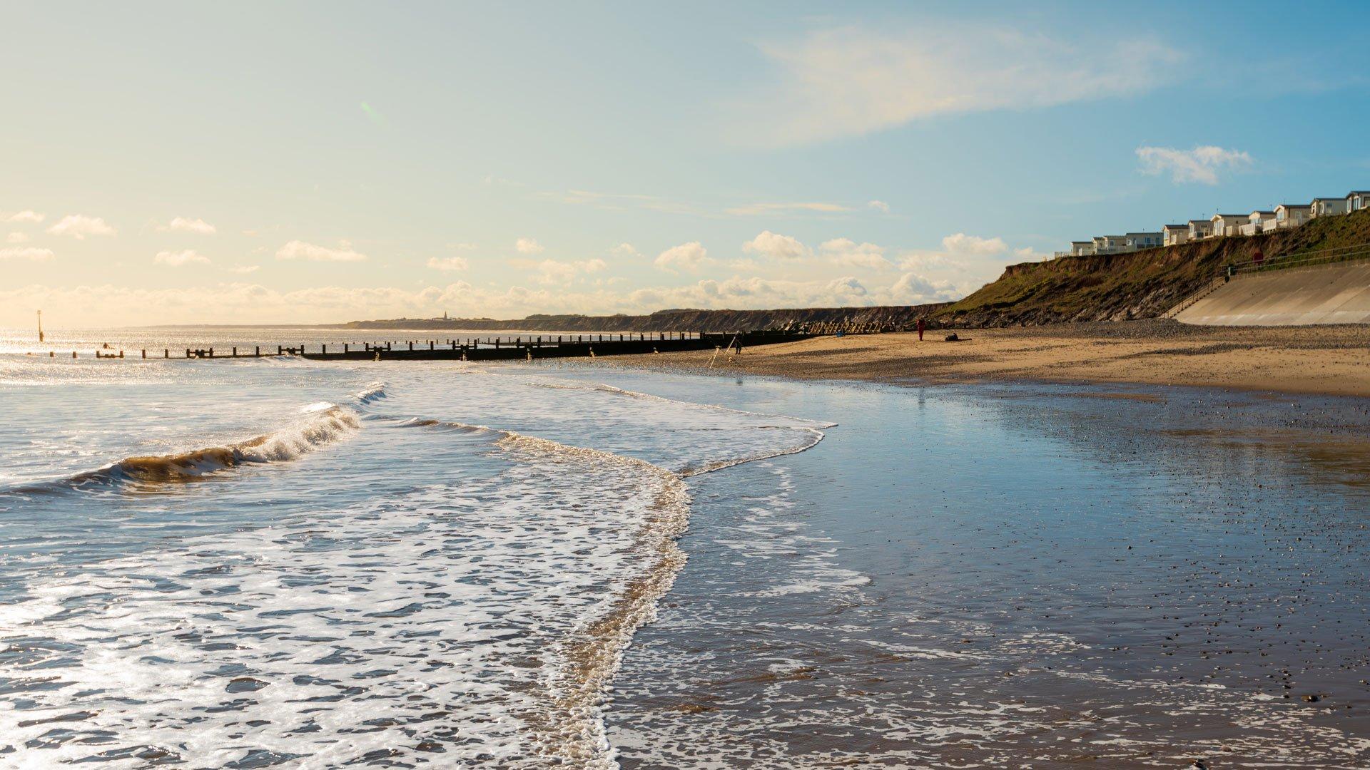
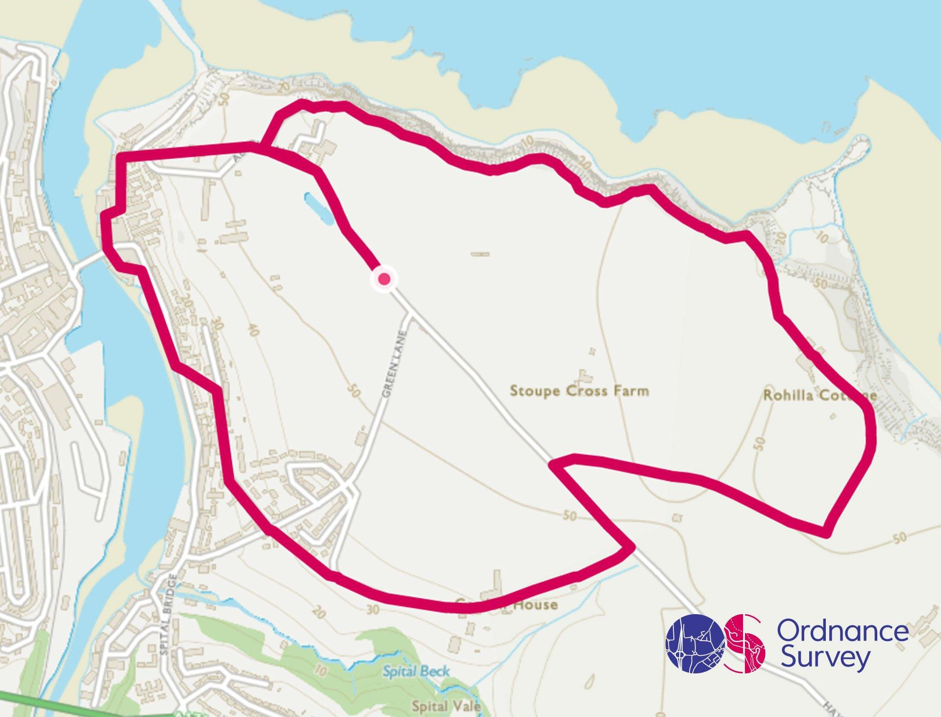
Whitby Circular Walk
Grade: Easy
Terrain: Coast
Distance: 6.5km | Approx. Time: 1:40 – 2:15 hours
Ordnance Survey Map: Explorer OL27
Ordnance Survey Digital Map Here.
Whitby is a seaside town and port, situated on the east coast at the mouth of the River Esk. Its East Cliff is home to the ruins of Whitby Abbey, a monastery dating back to the 7th-Century. The dissolution of the Monasteries happened between 1536 and 1545, so the abbey and its possessions were confiscated by the crown under Henry VIII. You can visit the Abbey to find out more about Caedmon, the first named English poet, and Bram Stoker, the author of 'Dracula'. The River Esk flows due North through the centre of the town dividing it into East and West Sides, linked by the swing-bridge. The West Side of the town has some historic fishermen’s’ cottages, hidden in traditional yards. Being by the coast means any excuse to sample some fish and chips, Whitby is famous for it. When visiting Whitby, you can also explore its beautiful beaches and the North York Moors National Park.
Countryside
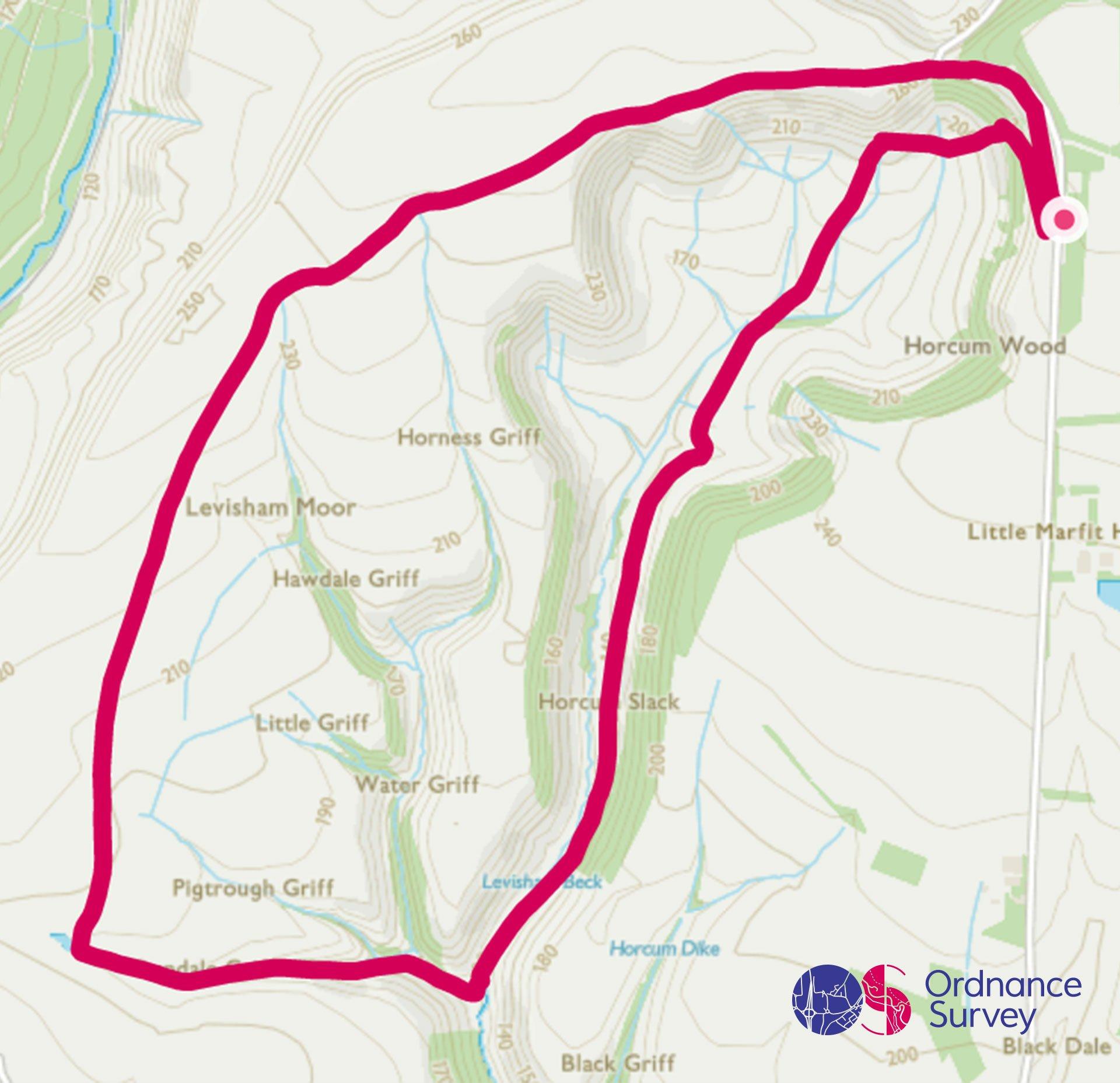
Hole of Horcum Circular Walk
Grade: Moderate
Terrain: Countryside
Distance: 8.1km | Approx. Time: 2.00 - 2:30 hours
Ordnance Survey Map: Explorer OL27
Ordnance Survey Digital Map Here.
The Hole of Horcum is a circular walk on the North York moors, and is a section of the valley of the Levisham Beck, upstream of Levisham and Lockton, in the Tabular Hills. This circular route is around this distinctive hollow in the hills. The hollow is 400 feet (120m) deep and about ¾ mile (1.2 km) across. The route is a mixture of moorland and valley so offers a varied and interesting walk. The North York Moors has an abundance of flora including primrose, bluebells, yellow archangel, wood anemone, cow-wheat and violets. Wildlife that can be encountered in the National Park: badger, fox, stoat, weasel, wood mouse and shrew. You may see both roe and fallow deer, if you get up early enough or if you walk late enough. Various bird watching hides are spread across the National Park at Scaling Dam, Howsham Mill and The Moors National Park Centre, Danby in Crow Wood.
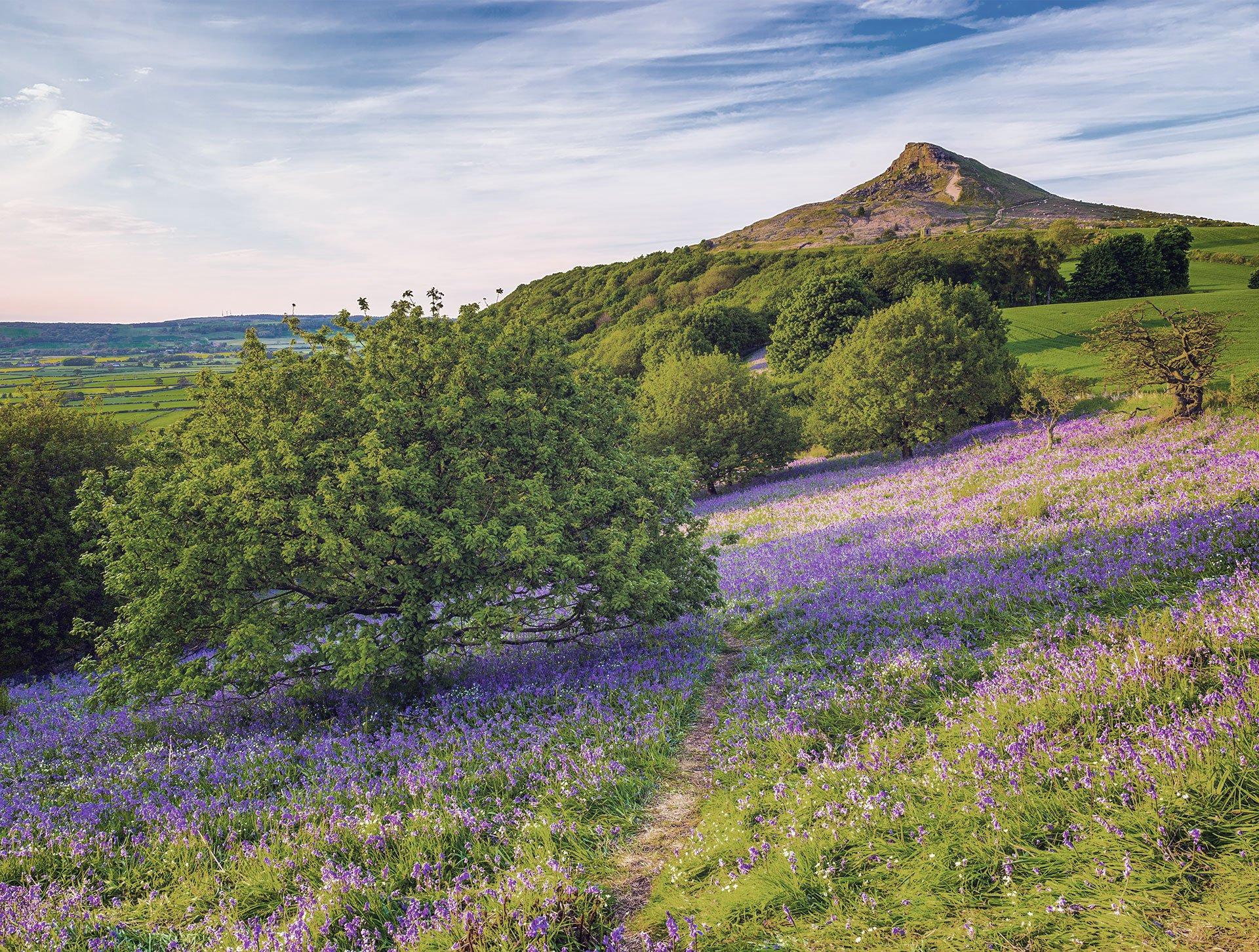
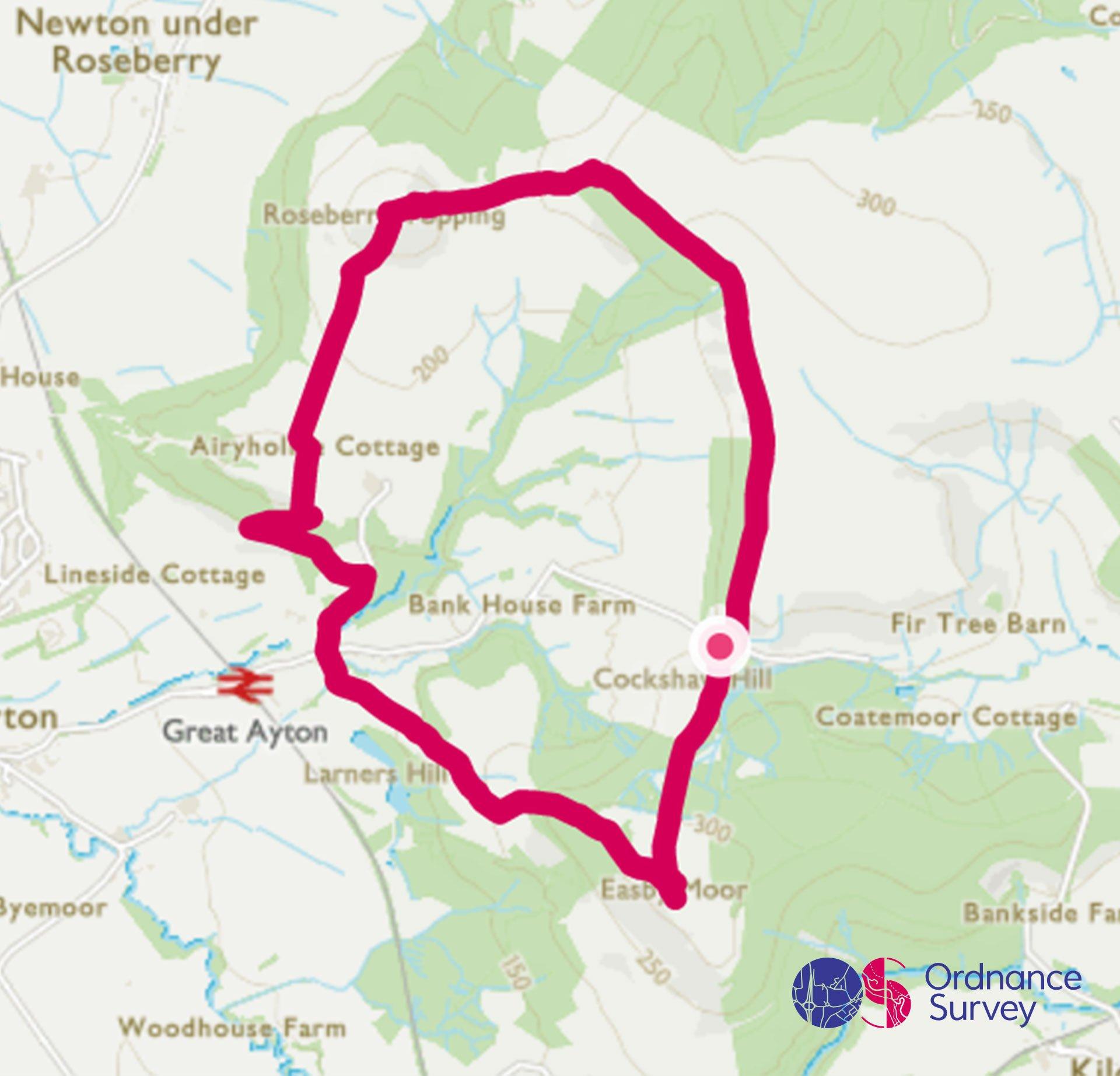
Roseberry Topping & Captain Cook's Monument Circular Walk
Grade: Challenging
Terrain: Countryside
Distance: 10km | Approx. Time: 1.30 - 2:00 hours
Ordnance Survey Map: Explorer OL26
Ordnance Survey Digital Map Here.
Roseberry Topping is a distinctive hill in North York Moors and is situated near Great Ayton and Newton-under-Roseberry. The summit has a distinctive half-cone shape with a jagged cliff with at a height of 320 metres. The summit offers outstanding views and the challenge of climbing to the top is extremely rewarding. Captain Cook's Monument is situated on Easby Moor, and was built in 1827by Robert Campion, a banker from Whitby, in memory of the famous circumnavigator who lived in Great Ayton as a young boy. Great Ayton is a village and civil parish in the Hambleton District on the edge of the North York Moors, it’s an ideal base for exploring the moors.
Add the paper map detailed in the route to your collection with 40% off all Ordnance Survey maps. Need help with your map reading? Read our Map Reading with Ordnance Survey guide.
The North York Moors is made for adventure. So where will you explore first? Share your snaps and tag us in your adventures using #mymillets.