We believe there is no better way to explore Great Britain than on foot or bike. To prove that point, we’ve teamed up with Ordnance Survey, the national mapping agency, to share the best routes they recommend in Great Britain.
In this guide we set our sights on the paths and trails which mark out the Loch Lomond & The Trossachs National Park in Scotland’s Central Belt, as a place made for adventure. We’ve split the routes into categories and provided the Ordnance Survey map you’ll need; plus, you can explore the route virtually using the recorded ‘Fly Through Videos’. So lace up your walking boots, pack your snacks and join us as we explore the best routes for walkers, cyclists and families in Loch Lomond & The Trossachs.
A Quick Guide to Exploring Britain Responsibly
- Check and follow the latest Government guidelines for England, Scotland & Wales
- Plan ahead
- Take the right gear
- If it feels too busy, consider another option
- Read our simple Guide to Map Reading with Ordnance Survey & Knowing Your Compass
Forest
Lake
Mountain
Recommended Routes in Loch Lomond & The Trossachs
Lace up your walking boots, pack your snacks and join us as we explore the best routes for walkers, cyclists and families in Loch Lomond & The Trossachs.
Forest
Loch Ard Forest Circular Walk
Grade: Easy
Terrain: Forest
Distance: 5.7km | Approx. Time: 1:15 - 1:40 hours
Ordnance Survey Map: Explorer OL46
Ordnance Survey Digital Route Here.
Loch Ard Forest is part of the Queen Elizabeth Forest Park and stretches from just north of Drymen almost to the banks of Loch Katrine. There is a variety of landscapes, wildlife, flora and fauna and is managed by the Forestry Commission. Within the forest there are various other routes that can be explored on foot or bike. Aberfoyle is where this route starts; the village sits on the infant River Forth. The attractive main street is well served with individual shops, cafes, and restaurants. Learn more about the area at the Trossachs Discovery Centre and the Scottish Wool Centre which is also located in the village. The Lodge Forest Visitor Centre just a couple of miles up the road offers arguably the most spectacular views in the area, a fantastic play area, and a wildlife station with CCTV viewing of ospreys, blue tits and many more species.

Lake
Loch Katrine
Grade: Moderate (Due to Length)
Terrain: Lake
Distance: 21.0km | Approx. Time: 5:00 - 6:00 hours
Ordnance Survey Map: Explorer 392
Ordnance Survey Digital Route Here.
Loch Katrine is a freshwater loch in the Loch Lomond and Trossachs National park. The loch is 8.1miles long and 0.62 miles wide at the widest point and is a key water source for the city of Glasgow. To start the walk, you will need to book with Loch Katrine Cruises and purchase a ticket to Stronachlachar pier. There you can depart the boat and walk back along the shore road, the road is private offering a secluded and peaceful walk back. If you book the Sir Walter Scott Steamship, you will be able to look down into the engine room. This route can also be cycled; Loch Katrine Cruises also offer you to book your bike on board. If walking or cycling is not your thing, then you can simply just book a return journey on the boat and take in the beautiful views. Please note the ferry is only available in the summer and winter months at weekends: check the Loch Katrine Cruises website for full details.

Mountain
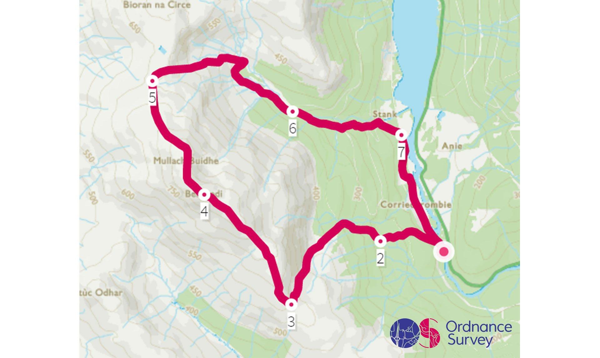
Ben Ledi Circular Walk
Grade: Challenging
Terrain: Mountain
Distance: 9.8km | Approx. Time: 3:15 - 4:15 hours
Ordnance Survey Map: Explorer OL46
Ordnance Survey Digital Route Here.
Ben Ledi is a mountain that sits at 879 m high, and is classified as a Corbett; a Corbett is a Scottish hill between 2500 and 2999 feet high with a drop of at least 500 feet (152.4m) on all sides. Ben Ledi sits beside Loch Lubnaigin the Loch Lomond and Trossachs National Park and makes an excellent viewpoint. The area is famous for its expansive lochs which include Loch Katrine and Loch Lomond. Callender is the closest town, situated on the River Teith, and the town serves as the eastern gateway to the Loch Lomond and the Trossachs National Park, the first National Park in Scotland. It is often referred to as the "Gateway to the Highlands". Loch Katrine is steeped in History and worth exploring upon the loch cruise aboard the Sir Walter Scott Steamship.
Goatfell, Isle of Arran
Grade: Challenging
Terrain: Mountain
Distance: 16.1km | Approx. Time: 4:45 - 5:30 hours
Ordnance Survey Map: Explorer OL46
Ordnance Survey Digital Route Here.
Goatfell is the highest point on the Isle of Arran. At 874 metres and is one of four Corbetts on the island. A Corbett is a Scottish hill between 2500 and 2999 feet high with a drop of at least 500 feet (152.4m) on all sides. Goatfell is believed to mean 'Goat Mountain' in Norse. Goatfell can be climbed either as a day trip from the mainland by using the ferry link from Ardrossan, or direct from the Island. Climbing to the top Goatfell you will be rewarded with outstanding views of the island and out to sea. Brodick is the main village on the island and has a selection of places to stay, eat and shop. The Isle of Arran is one of the very few places in Scotland to have a climate that is temperate enough for palm trees to grow.
Add the paper map detailed in the route to your collection with 40% off all Ordnance Survey maps.
Scotland is made for adventure. So where will you explore first? Share your snaps and tag us in your adventures using #mymillets.