Recommended Routes: South West of England
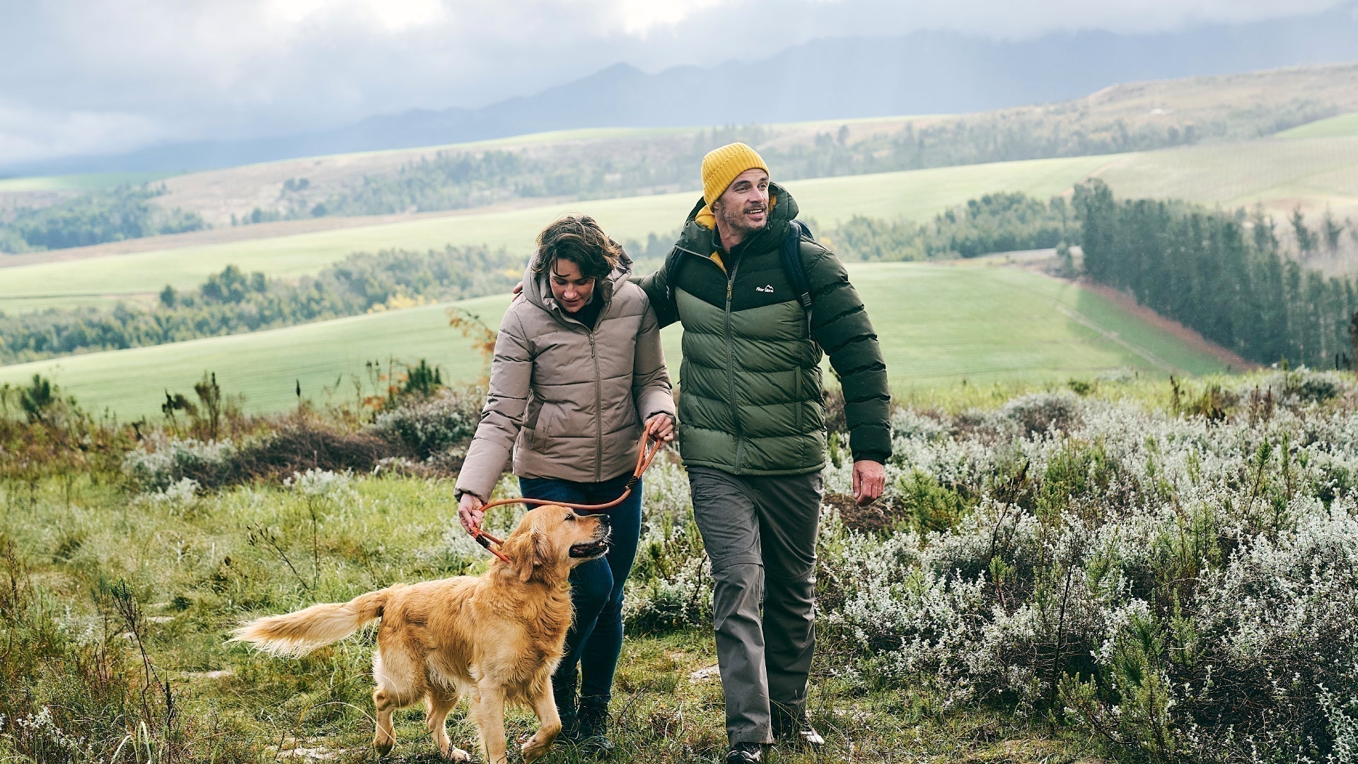
We believe there is no better way to explore Great Britain than on foot or bike. To prove that point, we’ve teamed up with Ordnance Survey, the national mapping agency, to share the best routes they recommend in Great Britain.
In this guide we lace up ready to explore the coastal trails and spectacular landscapes paths which map out the large region of the South West including two National Parks and four World Heritage Sites. We’ve split the routes into categories i.e. lake, hill, mountain, with grade levels (Easy, Moderate, Challenging, Mountain). You'll also find the Ordnance Survey map you’ll need; plus, you can explore the route virtually using the recorded ‘Fly Through Videos’. Use the Navigation below to select Countryside, Coast or Valley routes.
A Quick Guide to Exploring Britain Responsibly
- Check and follow the latest Government guidelines for England, Scotland & Wales
- Plan ahead
- Take the right gear
- If it feels too busy, consider another option
- Read our simple Guide to Map Reading with Ordnance Survey & Knowing Your Compass

Countryside
Coast
Valley
Recommended Routes in the South West of England
Lace up your walking boots, pack your snacks and join us as we explore the best routes for walkers, cyclists and families across the South West of England.
Countryside
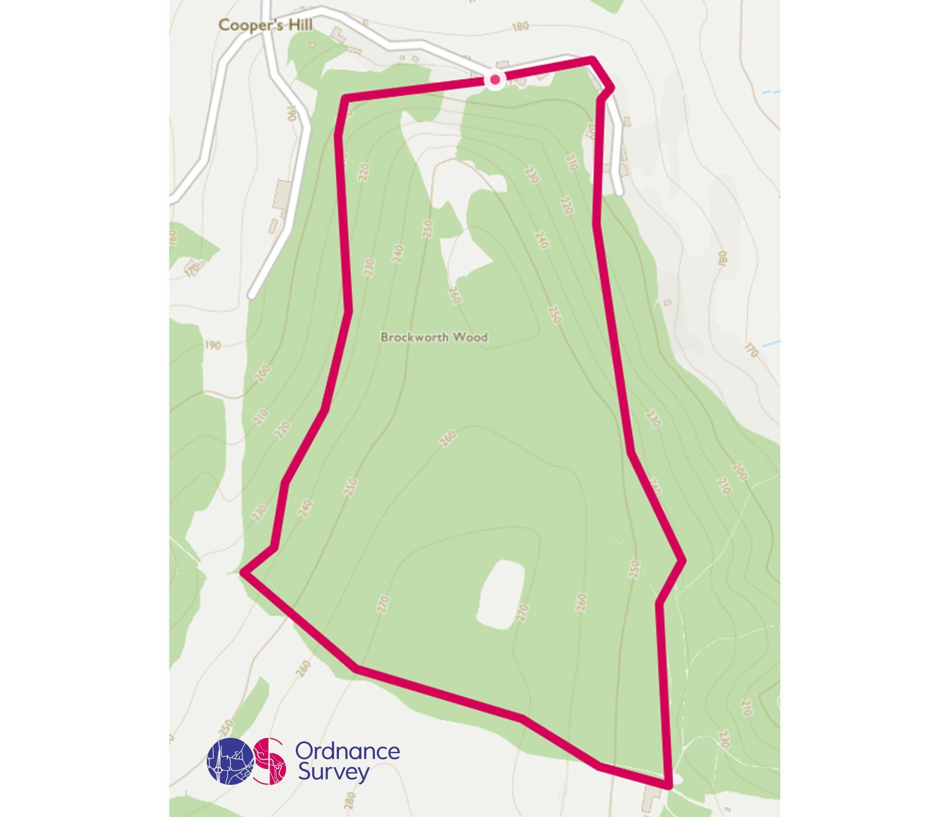
Coopers Hill Circular Walk, Gloucestershire
Grade: Easy
Terrain: Countryside
Distance: 2.7km | Approx. Time: 1 hour
Ordnance Survey Map: Explorer Active 179 Gloucester, Cheltenham & Stroud
Ordnance Survey Digital Map Here.
If you’re after a leisurely wander in the woods then why not try this circular walk around Coopers Hill nature reserve, situated to the South East of Gloucester on the edge of the Cotswolds. Depending on the time of year a walk through this ancient beech woodland you might be able to see bluebells, purple orchids and Speckled Wood butterflies. Alternatively, you may like to visit Coopers Hill for the annual cheese rolling contest and chase a Double Gloucester cheese down the 200-yard hill.
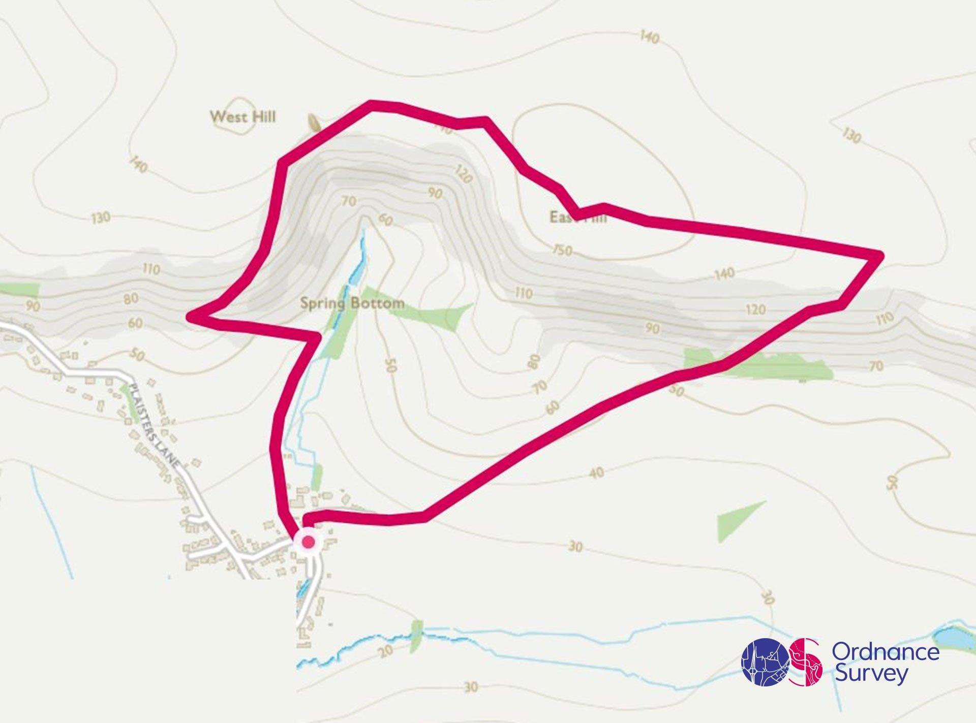
Osmington White Horse Circular Walk, Dorset
Grade: Moderate
Terrain: Countryside
Distance: 3.9km | Approx. Time: 1:00 – 1:30 hours
Ordnance Survey Map: Landranger 194 Dorchester & Weymouth, Cerne Abbas & Bere Regis
Ordnance Survey Digital Map Here.
White Horse hill stands tall over the pretty village of Sutton Poyntz, a beautiful wide-open space with views all along the spectacular Dorset Coast. This short walk climbs steep grassy downs from the village, then enjoys a more relaxing ramble along the crest, high above the world. The return leg passes close to the White Horse itself, a chalk figure of King George III cut in 1808. His majesty and his horse are 85m long and 98m tall, and to get the best view of them from a distance, it’s worth stopping off at the viewpoint layby on the A353 on your way home.
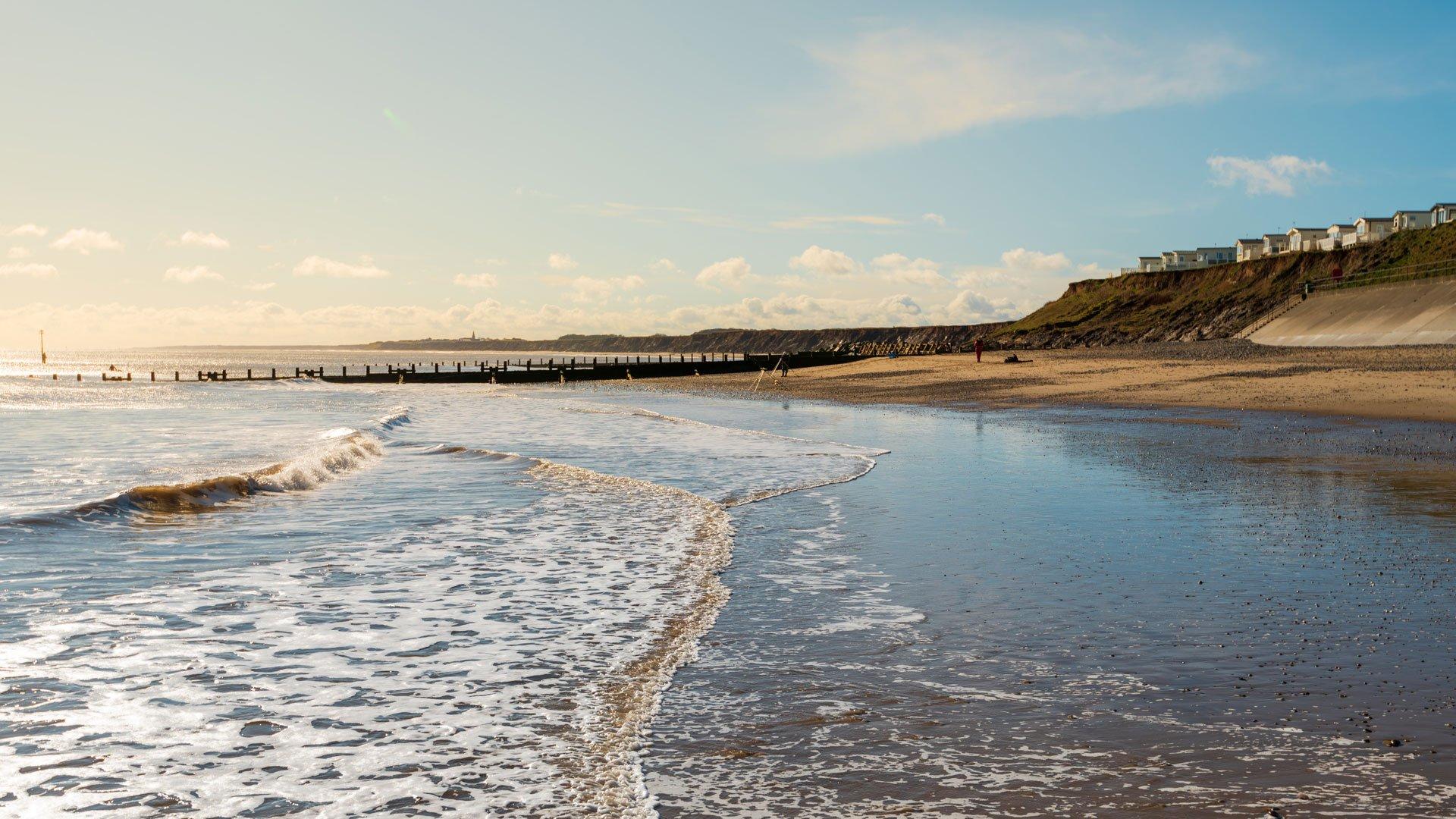
Coast
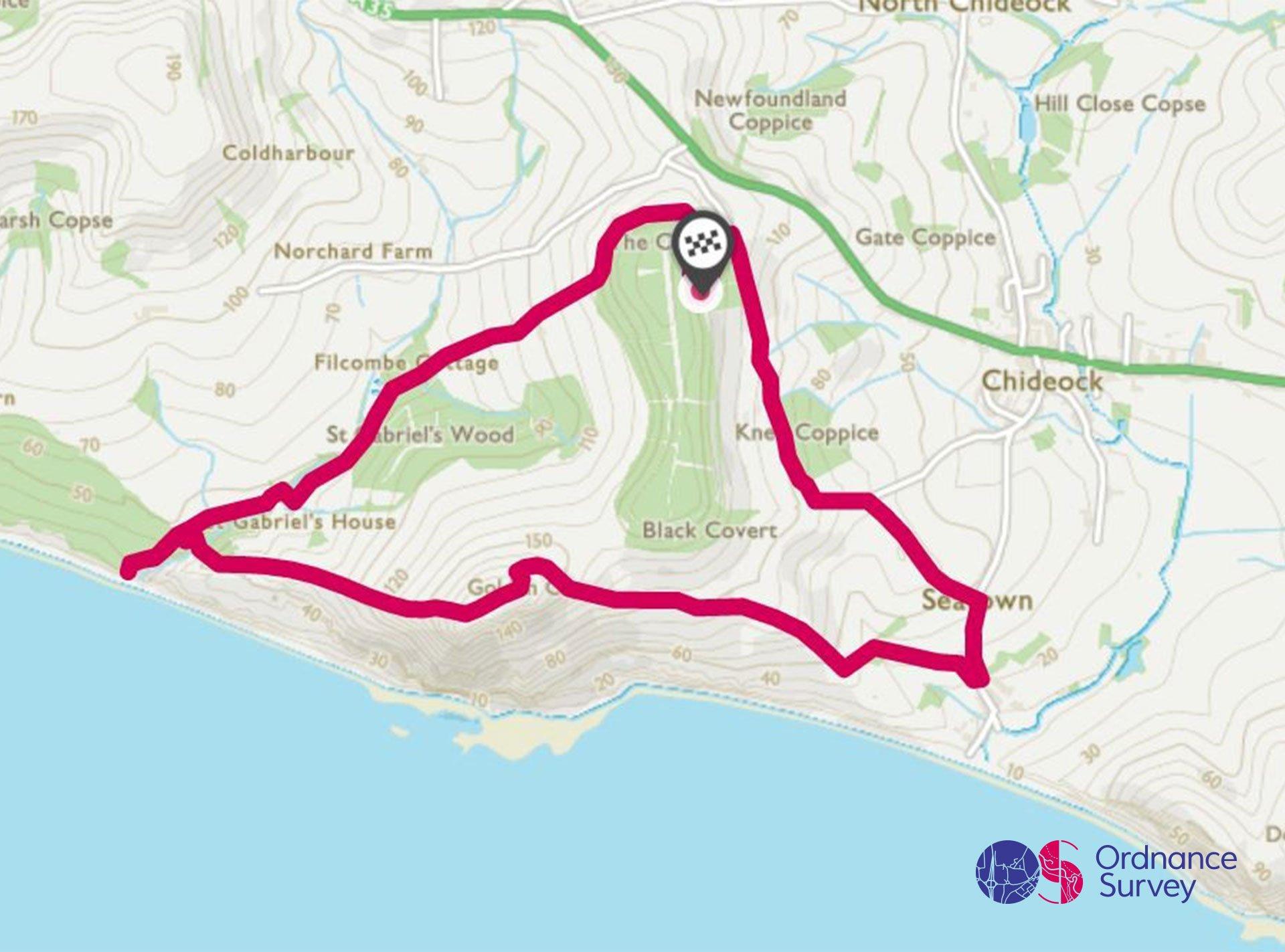
Golden Cap Circular Walk, Dorset
Grade: Moderate
Terrain: Coast
Distance: 6.8km | Approx. Time: 2:00 – 2:30 hours
Ordnance Survey Map: Landranger Active 116 Denbigh & Colwyn Bay
Ordnance Survey Digital Map Here.
Arguably the highest point on the whole of the south coast, Golden Cap feels like a proper summit, with fantastic views from its top high above the sea. The cliffs here are forever changing, crumbling and slipping, and as part of the Jurassic Coast World Heritage Park are one of the most important and spectacular parts of our entire coastline. This circular walk starts further inland, following a gentle valley down to the sea, before climbing up to the summit with is outstanding vistas. There are a couple of opportunities to shorten the walk, or to extend down into Sea town for a well-deserved ice cream.
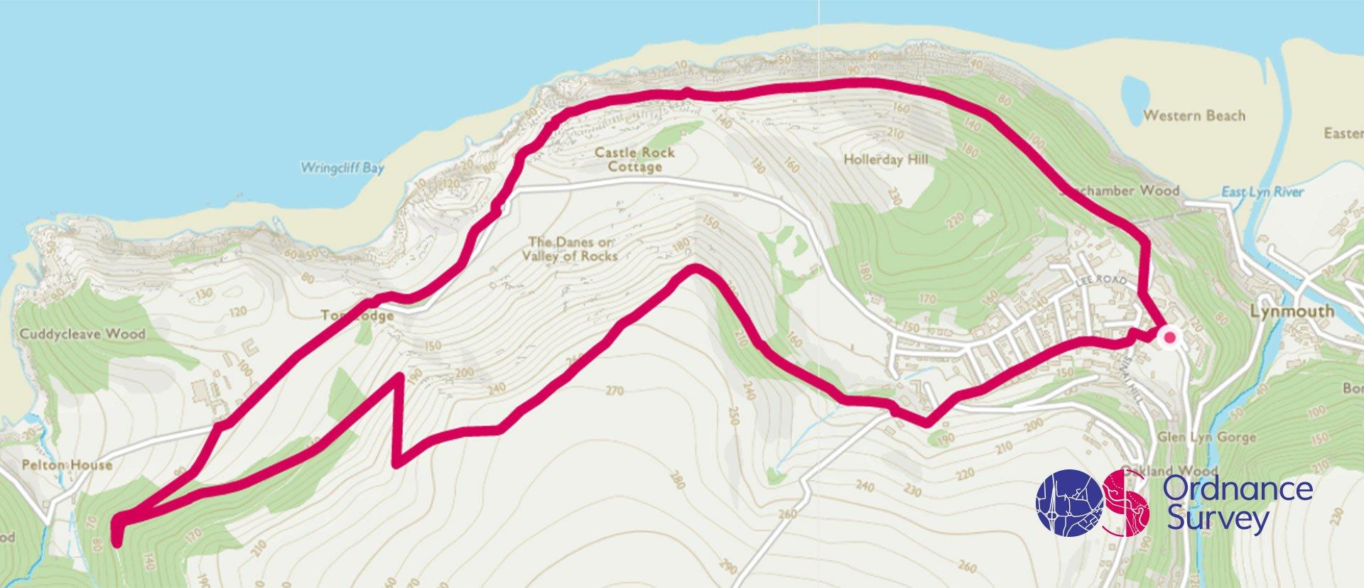
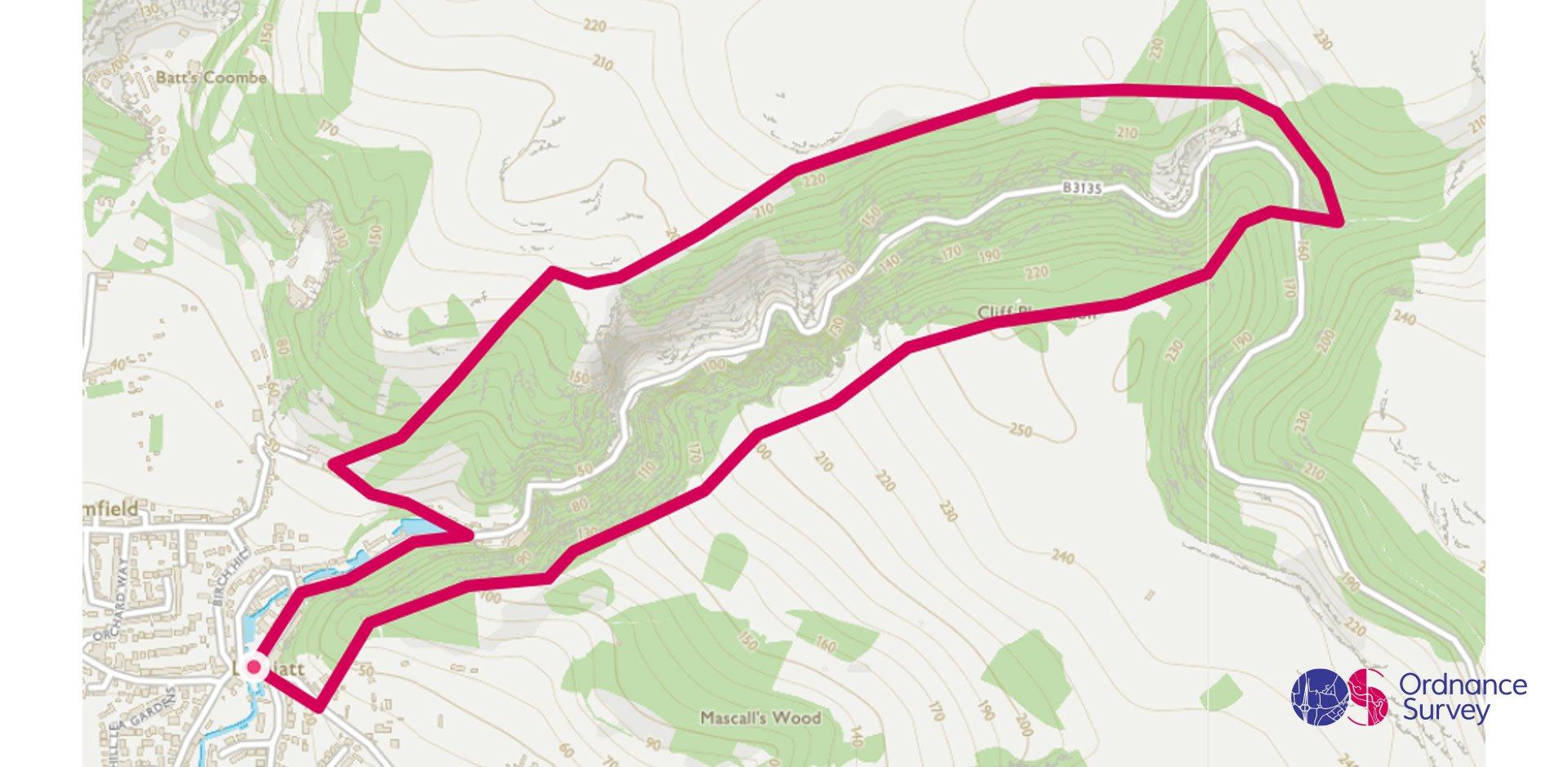
Valley of the Rocks Circular Walk, Lynton, Devon
Grade: Moderate
Terrain: Coast
Distance: 6.5km | Approx. Time: 2:00 – 2:30 hours
Ordnance Survey Map: Explorer OL9 Exmoor
Ordnance Survey Digital Map Here.
Whether you’re starting this walk in the picturesque village of Lynton or getting the Cliff railway up from nearby Lynmouth the Valley of Rocks never ceases to amaze. Appearing to rise out of the sea below affording you views of the wilds of Wales across the Bristol channel will you be able to spot the herds of feral goats that call this place their home or will you be inspired to write a poem like Wordsworth and Coleridge in 1797. For those wishing to see more a visit to Waters meet on the opposite side of the valley from Lynton is a must.
Valley
Cheddar Gorge Circular Walk, Somerset
Grade: Moderate
Terrain: Valley
Distance: 5.6km | Approx. Time: 1:30 – 2:00 hours
Ordnance Survey Map: Explorer 141 Cheddar Gorge & Mendip Hills West
Ordnance Survey Digital Map Here.
At nearly 400ft deep and 3 miles (4.8km) long Cheddar gorge is England’s longest; this spectacular walk takes you around either side of the Gorge so you can admire its grandeur. Whichever way round you decide to go its worth stopping at Pulpit Rock, which gives you a great overview of the Gorge. You’ll drop down into the Gorge at Black Rock, where the there’s a fantastic example of an old Lime Kin, originally built in 1904.Once you’ve done the routes its worth popping into Cheddar Gorge itself to experience the caves and see where Cheddar Man, Britain’s oldest complete human skeleton, used to live 9000 years ago.
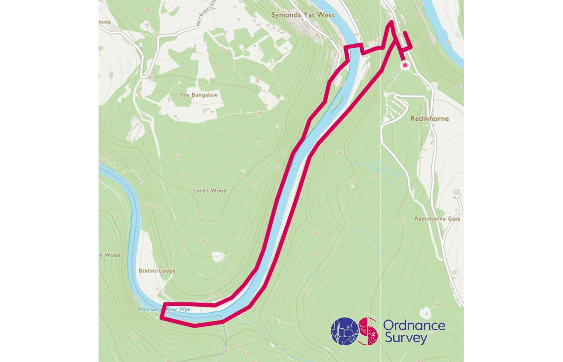
Symonds Yat Circular Walk
Grade: Moderate
Terrain: Valley
Distance: 5.7km | Approx. Time: 1:30 – 2:00 hours
Ordnance Survey Map: Explorer OL14 Wye Valley & Forest of Dean
Ordnance Survey Digital Map Here.
Starting this circular walk at the top of the hill at Symonds Yat rock gives you spectacular views of the Wye valley and with a little patience Peregrine Falcons, Goshawks and Buzzards that call the Wye valley their home. Taking the gentle footpath to the valley floor you’ll walk along the former Ross on Wye to Monmouth railway line, cross the Wye at the footbridge and investigate Dropping Wells spring before heading back to Symonds Yat West to cross the river on the hand operated foot ferry, it’s worth double checking that the ferry is operating before heading down river. For those wanting to see more of the valley there are a number of family friendly cycle routes that start from Symonds Yat rock.
Add the paper map detailed in the route to your collection with 40% off all Ordnance Survey maps. Need help with your map reading? Read our Map Reading with Ordnance Survey guide.
The South West of England is made for adventure. So where will you explore first? Share your snaps and tag us in your adventures using #mymillets.