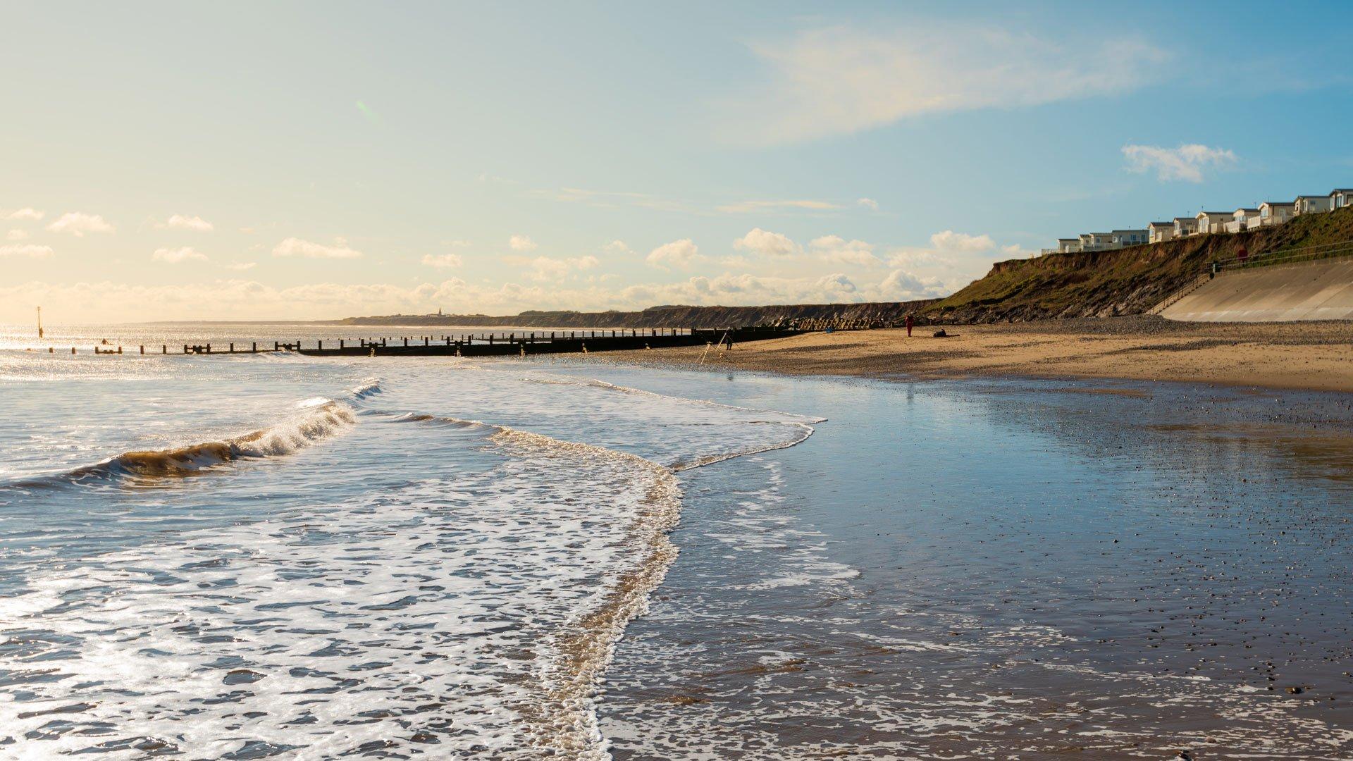
Best Dog Walks in the UK: 50+ Family‑Friendly Routes Near You
Not all dog-friendly hikes are created equal. While some offer open space, clear paths and varied scenery, others can be difficult to navigate, overcrowded, or poorly suited to dogs.
With dog ownership at record levels across the UK, more walkers are looking for routes that balance scenery with accessibility, offering safe terrain and a better overall experience for two and four-legged adventurers alike.
To find out which hikes truly deliver, Millets analysed more than 114,000 real walker reviews, scoring routes based on popularity, ratings, and terrain difficulty.
The results reveal a clear pattern: the UK’s best dog-friendly hikes favour well-maintained paths, varied landscapes, and manageable routes, with England dominating the rankings.
So, lace up those walking boots, grab your rucksack, and get exploring.
Jump to:
- Our findings at a glance
- The best dog-friendly walks and hikes in the UK
- The UK’s best dog-friendly hikes avoid difficult terrain
- The best dog-friendly walks and hikes in Scotland
- The best dog-friendly walks and hikes in Wales
- The best dog-friendly walks and hikes in Northern Ireland
- The best ‘easy’ dog-friendly walks and hikes
- The best ‘moderate’ dog-friendly walks and hikes
- The best ‘hard’ dog-friendly walks and hikes
- Expert tips for hiking with your dog
- Methodology

Our findings at a glance:
-
Eight of the UK’s top ten dog-friendly walks and hikes are in England
-
The Malham Landscape Trail in the Yorkshire Dales ranks #1 overall
-
The Lake District dominates, with multiple top-ranking routes
-
Scotland’s highest-rated hike is Coire Gabhail (The Lost Valley) in Glencoe
-
Wales’ top route is Newborough Beach – a flat, accessible coastal walk
-
Across the 50 best dog-friendly routes analysed, 56% are rated as ‘moderate’, 24% as hard, and 20% as easy
-
Every hike in the top ten is rated easy or moderate, highlighting demand for accessible trails.
The best dog-friendly walks and hikes in the UK

The UK's best dog-friendly hikes aren't necessarily the longest or most challenging; they're the ones that strike the right balance. Good scenery, manageable paths, and enough space for your dog to actually enjoy themselves.
That may be because, as Emma Johnson from Dog Owner’s Guide explains, “you wouldn’t go from a short stroll to a full day hike overnight...and it’s the same for dogs”. Building up gradually, with varied terrain, and allowing time for recovery are often what make moderate routes feel more enjoyable for both dogs and owners.
Across the top-ranking routes, this trend is clear: highly rated hikes tend to combine well-maintained paths with varied landscapes, whether that’s waterfalls and woodland or lakes and coastal views.
|
Rank |
Trail |
Country |
Average user rating (/5) |
Total number of ratings |
Trail difficulty |
Dog-friendly hike score (/10) |
|
1 |
Malham Landscape Trail: Janet's Foss, Gordale Scar, and Malham Cove |
England |
4.8 |
7,396 |
Moderate |
9.37 |
|
2 |
Hawes End, Cat Bells, and Derwent Circular |
England |
4.8 |
4,178 |
Moderate |
8.96 |
|
3 |
Aira Force and Gowbarrow Park Circular |
England |
4.8 |
3,843 |
Moderate |
8.76 |
|
4 |
Buttermere Circular |
England |
4.8 |
2,802 |
Moderate |
8.48 |
|
5 |
Coire Gabhail (The Lost Valley) |
Scotland |
4.8 |
2,754 |
Moderate |
8.42 |
|
6 |
Rydal Water and Cave Circular |
England |
4.7 |
4,549 |
Easy |
7.80 |
|
7 |
Simonside and Dove Crag Circular |
England |
4.8 |
1,544 |
Moderate |
7.46 |
|
8 |
Newborough Beach and Ynys Llanddwyn |
Wales |
4.8 |
804 |
Easy |
7.40 |
|
9 |
Box Hill, Lodge Hill and Juniper Hill Circular |
England |
4.7 |
5,007 |
Moderate |
7.39 |
|
10 |
Castleton, Mam Tor, and The Great Ridge Circular |
England |
4.7 |
4,748 |
Moderate |
7.33 |
-
Malham Landscape Trail – 9.37/10
Yorkshire Dales, England | 5.1 miles | 2.5-3 hrs | Moderate | Parking available
Ranking first overall with a score of 9.37/10 and more than 7,000 reviews, this Yorkshire Dales route stands out for combining dramatic scenery with a manageable, well-marked trail from start to finish.
The circular walk takes in Janet’s Foss waterfall, the limestone gorge of Gordale Scar, and the iconic Malham Cove, all within just five miles, making it one of the most rewarding short hikes in the UK.
Walkers describe it as "a nice, fairly easy trail with stunning views and a clearly marked path." Some of the route passes through working farmland, so expect to keep your dog on a lead for stretches. Reviews also flag a high stile midway through with no alternative route, which is worth knowing if you have a larger dog that needs a lift.
Two dog-friendly pubs in Malham village provide a convenient (and well-earned) finish point, reinforcing this route’s appeal as a complete day-out route rather than just a walk.
Top tip: Parking gets busy on sunny days, so an early start is recommended if you want to secure a space.
-
Hawes End, Catbells, and Derwent Circular – 8.96/10
Lake District, England | 4.5 miles | 2-2.5 hrs | Moderate | Parking available
Catbells is a true Lake District classic, and the reviews back it up. Over 4,000 walkers have rated this route 4.8/5, making it the second-highest-scoring dog-friendly hike in the UK.
The route splits into two very different halves: a proper climb to the Catbells summit, with some scrambling near the top, followed by a gentle lakeside stroll back along Derwentwater. Walkers recommend tackling the scramble on the ascent and taking the easier southern path on the way down.
There are no exposed ridges, so most dogs handle it well, though you may find it better to keep them on the lead when walking through busier sections near the summit.
Top tip: Avoid the double yellow lines, as walkers mention that traffic wardens regularly patrol here. Parking further along the road is worth the extra few minutes' walk.
-
Aira Force and Gowbarrow Park Circular – 8.76/10
Ullswater, Lake District, England | 4.4 miles | 2-2.5 hrs | Moderate | Parking available
Few walks pack in as much as this one. Ancient woodland, a spectacular 65-foot waterfall, open fellside, and sweeping views across Ullswater, England's second largest lake, all in under 5 miles. Walkers sum it up simply: "great paths, amazing views and great for dogs."
With 3,843 reviews and a rating of 4.8/5, it's consistently one of the most popular routes in the Lakes.
Dogs are generally fine off the lead, though signs at the gates request leads near cattle, so it’s important to check on the day.
There's a café and toilets on site, but the National Trust car park can get busy at peak times. Luckily, there's additional parking nearby along the lakeshore.
Top tip: Walkers note that the descent from Gowbarrow can get icy in colder conditions, so a good pair of walking boots, and possibly walking poles, are a must.
The UK’s best dog-friendly hikes avoid difficult terrain
Difficulty clearly affects how dog-friendly and enjoyable a hike is perceived to be.
Across the full dataset of 50 hikes:
-
56% are rated moderate
-
24% are rated hard
-
20% are rated easy
But among the top 10 hikes, the pattern is even clearer:
-
80% are moderate
-
20% are easy
-
0% are hard
This suggests the UK’s best dog-friendly hikes are not the most technical or strenuous. Instead, they tend to offer a balance of scenery, space, and manageable terrain that suits a wider range of dogs and owners.
The best dog-friendly walks and hikes in Scotland
Scotland’s highest-rated dog-friendly hikes tend to combine dramatic landscapes with relatively compact, rewarding routes.
While the terrain is often more rugged than elsewhere in the UK, the top-performing trails still balance challenge with accessibility, offering clear paths, varied scenery, and enough space for dogs to explore safely.
|
Rank |
Trail |
Average user rating (/5) |
Total number of ratings |
Trail difficulty |
Dog-friendly hike score (/10) |
|
1 |
Coire Gabhail (The Lost Valley) |
4.8 |
2,754 |
Moderate |
8.42 |
|
2 |
The Prison Walk |
4.8 |
1,233 |
Moderate |
7.19 |
|
3 |
Fairy Pools |
4.6 |
3,837 |
Easy |
7.12 |
|
4 |
The Dry Dam Path to Saint Anthony's Chapel and Arthur's Seat |
4.7 |
2,847 |
Moderate |
6.65 |
|
5 |
Conic Hill via Balmaha Circular |
4.7 |
1,780 |
Moderate |
5.90 |
|
5 |
Loch an Eilein Circular |
4.7 |
1,166 |
Easy |
5.90 |
|
7 |
Tom a' Ghrianain (Signal Rock), An Torr, and Hagrid's Hut Circular |
4.5 |
1,322 |
Moderate |
4.94 |
|
8 |
Ben Lomond Mountain Path |
4.7 |
2,040 |
Hard |
4.13 |
|
9 |
Ben Nevis from Glen Nevis Youth Hostel |
4.7 |
1,590 |
Hard |
3.72 |
|
10 |
West Highland Way: Drymen to Rowardennan |
4.7 |
929 |
Hard |
3.04 |
-
Coire Gabhail (The Lost Valley) – 8.42/10
Glencoe, Scotland | 3.1 miles | 2-3 hrs | Moderate | Parking available
There are hikes with great views, and then there's The Lost Valley. Tucked deep into the mountains of Glencoe, this hidden glen was used as a refuge by the MacDonald clan in the 17th century, and it still feels like a place few people know about, despite nearly 3,000 glowing reviews.
The route involves some serious scrambling across rocky, uneven terrain, which can be hugely enriching for agile, adventurous dogs who love to explore. Paths can be boggy after rain and icy in colder months, so waterproof boots are essential if you want to avoid wet feet!
The setting of Coire Gabhail is nothing short of extraordinary, but this is a hike that rewards those who come prepared.
Emma says weather conditions can change faster than many owners expect. She recalls one early morning hike where “because we’d taken it slower than expected, by the end it was hotter than we’d planned for”, reinforcing why “the goal is always to plan for every scenario rather than rely on getting out of it”.
Top tip: The car park on the A82 gets extremely busy in season. An early start or an off-season visit is strongly recommended, and if you're going between May and October, pack midge repellent.
-
The Prison Walk – 7.19/10
Isle of Skye, Scotland | 2.6 miles | 2-3 hrs | Moderate | Parking available
Don't let the name put you off! The Prison is a dramatic natural rock pinnacle that towers above you for most of the ascent – one of the most striking sights on any hike in Scotland.
At just 2.6 miles, it's one of the shorter routes on this list, but what it lacks in distance it more than makes up for in scenery. The rocky, mountainous terrain is great for dogs who like to scramble and explore, and the compact distance makes it a brilliant option if you want a big reward without a big time commitment.
Farm animals graze on the lower slopes, so a lead may be needed at the start. Higher up, the rugged open terrain is all yours.
Top tip: The path is rocky throughout, so walking boots or trail shoes are a must, and waterproofs are worth packing given Skye's famously changeable weather.
-
Fairy Pools – 7.12/10
Isle of Skye, Scotland | 2.7 miles | 1-1.5 hrs | Easy | Parking available
The Fairy Pools are one of Scotland's most magical sights. A series of crystal-clear waterfalls and pools that cascade down from the Cuillin mountains, leading to what’s easily one of the most photographed spots on the Isle of Skye.
The good news is that they're genuinely easy to reach. A wide, well-marked gravel path runs the full length of the walk, making it accessible for dogs and owners of all ages and abilities. With almost 4,000 reviews and counting, it's the most popular hike on this list in Scotland.
The pools are inviting for a swim, for dogs and owners alike, but be aware they're bracingly cold year-round, so bring appropriate clothing!
Top tip: For more adventurous walkers and dogs, the mountains looming behind the pools open up into a much longer, more challenging route. Be sure to pack extra food and water if you plan to head higher.
The best dog-friendly walks and hikes in Wales
Wales’ top-rated dog-friendly hikes reflect the country’s variety, covering everything from meandering coastal paths and forest trails to more demanding mountain routes.
The highest-ranking walks tend to offer a mix of open space, defined paths, and standout scenery, with accessible coastal routes performing particularly well for dog owners.
|
Rank |
Trail |
Average user rating (/5) |
Total number of ratings |
Trail difficulty |
Dog-friendly hike score (/10) |
|
1 |
Newborough Beach and Ynys Llanddwyn |
4.8 |
804 |
Easy |
7.40 |
|
2 |
Pen Y Fan Horseshoe |
4.8 |
3,978 |
Hard |
6.92 |
|
3 |
Rhaeadr Fawr (Aber Falls) Circular |
4.7 |
1,989 |
Moderate |
5.97 |
|
4 |
Moel Famau Circular |
4.7 |
1,600 |
Moderate |
5.69 |
|
5 |
Yr Wyddfa (Snowdon) via Llanberis Path |
4.7 |
9,181 |
Hard |
5.62 |
|
6 |
Cadair Idris, Mynydd Moel, Craig Lwyd, and Tal-y-Llyn Circular |
4.8 |
1,523 |
Hard |
5.49 |
|
7 |
Castell Dinas Bran Circular |
4.7 |
1,242 |
Moderate |
5.35 |
|
7 |
Capel Curig Circular |
4.7 |
626 |
Easy |
5.35 |
|
9 |
Four Waterfalls Trail from Clyngwyn |
4.7 |
1,033 |
Moderate |
5.08 |
|
10 |
Cadair Idris via Minffordd Path |
4.7 |
861 |
Hard |
2.97 |
-
Newborough Beach and Ynys Llanddwyn – 7.4/10
Anglesey, Wales | 3.7 miles | 1-1.5 hrs | Easy | Parking available
A beach walk, a forest, a lighthouse, wild horses, and ancient ruins – Newborough has it all, and it's easy to see why walkers describe it as a place that "never fails to bring joy."
The route winds through Newborough Forest first, with plenty of space for dogs to roam off the lead, before opening out onto a stunning beach with views across to the mountains of Eryri. The finale is Ynys Llanddwyn – a tidal island with a ruined church and old lighthouse that feels genuinely tucked away from the world.
It's rated easy, with flat, open paths throughout, making it a great option for dogs and owners of all ages and abilities. Remember to pack your swimwear or wetsuit if you fancy a dip in the sea after your walk!
Top tip: Dogs are restricted from parts of the beach at certain times of year, and leads are required on Llanddwyn Island itself. Check the seasonal restrictions before you go, and keep an eye on tide times for the island crossing.
-
Pen Y Fan Horseshoe – 6.92/10
Brecon Beacons, Wales | 9.3 miles | 5-7 hrs | Hard | Parking available
This route is ideal for dogs (and their humans) looking for a more demanding day out.
The Pen Y Fan Horseshoe is the most challenging Welsh hike on this list, taking in three peaks – Cribyn, Pen Y Fan and Corn Du – with over 2,600 feet of climbing across 9.3 miles. Don’t let that intimidate you, though; it’s fine to take it slow, and the panoramic views from the top are well worth every step. With almost 4,000 reviews and a rating of 4.8/5, walkers clearly agree.
The good news for dog owners is that most of the route is open access – walkers report dogs being off the lead for up to 90% of the hike. Going clockwise gives you the steep ascent upfront and incredible views right from the start.
It's a long, exposed route, so come prepared. Walkers strongly recommend bringing far more water than you think you'll need, for you and your dog.
Top tip: An early start pays dividends on this one, both to beat the heat on warmer days and to get the mountain largely to yourself.
-
Rhaeadr Fawr (Aber Falls) Circular – 5.97/10
Snowdonia, Wales | 4.3 miles | 2-2.5 hrs | Moderate | Parking available
The star of the show is Rhaeadr Fawr – one of the most dramatic waterfalls in North Wales, and well worth the walk on its own. But walkers who push on past the falls and complete the full circular are rewarded with sweeping views across the valley and out to the coast.
Dogs love it throughout, as there are plenty of streams and pools along the route for a drink and a paddle, and fresh water is never far away. Sheep graze in the fields, so leads are needed for stretches.
Be warned, though, the full loop involves some seriously muddy paths and a steep descent that walkers describe as a bit of a knee workout. Having a good pair of waterproof boots is essential for this trail, and gaiters can help in especially wet conditions.
Top tip: Get to the car park before 7.30am to beat the crowds, especially in summer. The path to the falls is well-made and easy to follow, but the circular route gets considerably wilder after that, in a good way!
The best dog-friendly walks and hikes in Northern Ireland
Northern Ireland’s best dog-friendly hikes stand out for offering quieter, less crowded routes without compromising on scenery.
The highest-rated trails combine coastal views, forest paths, and manageable terrain, making them well-suited to dogs while still delivering a varied and rewarding experience.
|
Rank |
Trail |
Average user rating (/5) |
Total number of ratings |
Trail difficulty |
Dog-friendly hike score (/10) |
|
1 |
Giant's Gate and Causeway Coast Circular |
4.8 |
996 |
Moderate |
6.92 |
|
2 |
Tollymore Forest and Drinns Circular |
4.8 |
306 |
Moderate |
6.31 |
|
3 |
Cavehill Circular |
4.7 |
1,036 |
Moderate |
5.15 |
|
4 |
Castlewellan Lakeside Circular |
4.6 |
185 |
Easy |
4.60 |
|
5 |
Trassey to Brandy Pad Circular |
4.8 |
325 |
Hard |
4.47 |
-
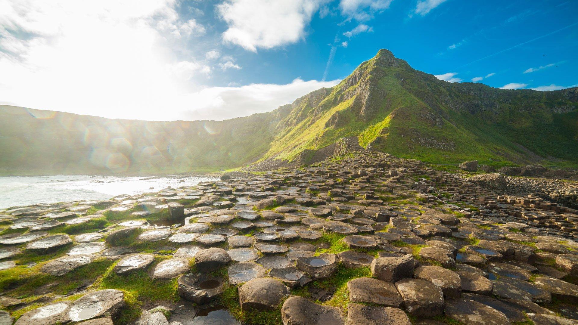
Giant’s Gate and Causeway Coast Circular – 6.92/10
Snowdonia, Wales | 2.8 miles | 1.5-2 hrs | Moderate | Parking available
The Giant's Causeway is one of the most iconic natural landmarks in the world – 40,000 interlocking basalt columns formed by ancient volcanic activity, jutting out into the Atlantic. But this longer circular route takes you well beyond the famous rocks and out along a rugged, dramatic coastline that most tourists never see.
After setting off from the visitor centre, the trick is to follow the coastal trail first, then loop back through the forest to keep the climbing to a minimum. Walkers report it's a lovely walk for dogs, with plenty to sniff and explore along the way.
Top tip: Some sections of the coastal path are overgrown, so be sure to check your dog for ticks after the walk (especially if you visit between March and October, when warmer, wetter weather makes the ticks more active).
-
Tollymore Forest and Drinns Circular – 6.31/10
County Down, Northern Ireland | 8.8 miles | 4.5-5 hrs | Moderate | Parking available
If Tollymore Forest looks familiar, there's a good reason – it's been used as a filming location for Game of Thrones. And once you're among the ancient trees, winding alongside the River Shimna and crossing old stone bridges, it's not hard to see why a fantasy series came calling.
For dogs, it's heaven, with walkers simply saying how their four-legged trail-mates “love it”. The route combines stony paths, rushing water, and dense woodland, offering something new around every corner for the entire 8.8 miles.
As one of the longer trails listed, make sure your dog has the stamina (and enough water) for a longer day out before you set off. Some riverside paths may be closed after periods of bad weather, so it's worth checking conditions before you go, and making sure you have a sturdy pair of waterproof boots.
Top tip: The route can be a little tricky to navigate – walkers have found themselves back at the start after covering only half the distance. A downloaded map or GPS is a good idea.
-
Cavehill Circular – 5.15/10
Belfast, Northern Ireland | 3.4 miles | 2-2.5 hrs | Moderate | Parking available
Cavehill is Belfast's backyard – a proper hill walk on the edge of the city, with stunning views across Belfast and out to the Irish Sea from the top. Walkers describe it as a little "more than just a dander", but this means there's a real sense of achievement when you reach the summit.
It's a popular spot with dog walkers (clocking up over 1,000 reviews), and you're guaranteed to meet plenty of fellow two- and four-legged hikers along the way. Be mindful that dogs should be kept on a lead throughout.
Top tip: The climb is steady rather than brutal, but you still need to be prepared. Supportive footwear and a bottle of water are both well worth packing.
The best ‘easy’ dog-friendly walks and hikes
Not every great walk needs to be a challenge. These routes combine flat or gently graded paths with strong scenery and clear navigation, making them ideal for older dogs, younger walkers, or anyone looking for a more relaxed day outdoors.
They can also be a great way to introduce dogs to hiking for the first time. As Emma explains, owners should “keep it simple and make it enjoyable”, starting with shorter, scenic walks before gradually building up distance and variety.
|
Rank |
Trail |
Country |
Average user rating (/5) |
Total number of ratings |
Dog-friendly hike score (/10) |
|
1 |
Rydal Water and Cave Circular |
England |
4.7 |
4,549 |
7.80 |
|
2 |
Newborough Beach and Ynys Llanddwyn |
Wales |
4.8 |
804 |
7.40 |
|
3 |
Fairy Pools |
Scotland |
4.6 |
3,837 |
7.12 |
|
4 |
Fairy Glen Circular |
England |
4.6 |
2,331 |
6.65 |
|
5 |
Virginia Water Circular |
England |
4.7 |
1,706 |
6.51 |
|
6 |
Dovestone Reservoir Circular |
England |
4.7 |
1,625 |
6.44 |
|
7 |
Loch an Eilein Circular |
Scotland |
4.7 |
1,166 |
5.90 |
|
8 |
Capel Curig Circular |
Wales |
4.7 |
626 |
5.35 |
|
9 |
Castlewellan Lakeside Circular |
Northern Ireland |
4.6 |
185 |
4.60 |
|
10 |
Antrim Castle Gardens to Lough Neagh |
Northern Ireland |
4.4 |
164 |
4.33 |
-
Rydal Water and Cave Circular – 7.8/10
Ambleside, Lake District, England | 2.7 miles | 1-1.5 hrs | Parking available
The Rydal Water and Cave Circular route is a Lake District classic that ticks every box – a dramatic cavern accessible by stepping stones, tranquil lakeside paths and stunning fell views, all on well-maintained, stile-free paths that are as easy on the dog as they are on you.
Across over 4,500 reviews, walkers describe it as "super dog friendly” with “no stiles and well-maintained paths", making it a great option for dogs and owners of all ages and abilities. If you’re visiting on a sunny day, Rydal Water is a great wild swimming spot, with easy access from gentle shores.
In the springtime, this route is one of the best spots to see bluebells in the Lake District. The woodland and fell-side sections come alive with colour between April and May, making it well worth timing your visit accordingly.
Top tip: Walkers report the car park filling up fast and costing up to £5 for two hours. Parking in a safe, legal spot slightly down the road saves both money and the stress of finding a space.
-
Newborough Beach and Ynys Llanddwyn – 7.4/10
Anglesey, Wales | 3.7 miles | 1-1.5 hrs | Parking available
If you're looking for an easy hike that genuinely doesn't feel like a compromise, Newborough is it. Walkers describe it as a "beautiful, easy walk with breathtaking views" – flat, wide open and varied enough to keep even the most easily distracted dog engaged from start to finish.
The route winds through Newborough Forest before opening out onto a stunning beach, finishing at the tidal island of Ynys Llanddwyn with its ruined church and old lighthouse. For dogs, the open space and easy terrain make it an absolute joy, with room to run on the beach, explore the forest, and paddle in the sea, all without a steep climb in sight.
Top tip: The reserve is large enough that even on busy days you can find quieter paths. If the main beach feels crowded, it's well worth exploring the forest trails to find your own space.
-
Fairy Pools – 7.12/10
Isle of Skye, Scotland | 2.7 miles | 1-1.5 hrs | Parking available
The Fairy Pools are proof that easy doesn't mean boring. A well-maintained gravel path makes this one of the most accessible hikes in Scotland, reflected by walkers describing it as "very flat and easy" with just one short steep section at the start that can be avoided on the return. It's a genuinely comfortable walk for dogs of all sizes and abilities.
The crystal-clear pools and waterfalls cascading down from the Cuillin mountains are as magical in person as they look in photos, and owners can enjoy watching their dogs paddling in the shallows along the way.
Top tip: If you're driving to the pools, be prepared for a long single-track road with passing places. Take it steady and let faster local traffic pass when you can.
The best ‘moderate’ dog-friendly hikes
Ready to step it up a little? Moderate routes offer a bit more variety – some elevation, longer distances and more varied terrain – but nothing that a decent pair of walking boots and a willing dog can't handle.
|
Rank |
Trail |
Country |
Average user rating (/5) |
Total number of ratings |
Dog-friendly hike score (/10) |
|
1 |
Malham Landscape Trail: Janet's Foss, Gordale Scar, and Malham Cove |
England |
4.8 |
7,396 |
9.37 |
|
2 |
Hawes End, Cat Bells, and Derwent Circular |
England |
4.8 |
4,178 |
8.96 |
|
3 |
Aira Force and Gowbarrow Park Circular |
England |
4.8 |
3,843 |
8.76 |
|
4 |
Buttermere Circular |
England |
4.8 |
2,802 |
8.48 |
|
5 |
Coire Gabhail (The Lost Valley) |
Scotland |
4.8 |
2,754 |
8.42 |
|
6 |
Simonside and Dove Crag Circular |
England |
4.8 |
1,544 |
7.46 |
|
7 |
Box Hill, Lodge Hill and Juniper Hill Circular |
England |
4.7 |
5,007 |
7.39 |
|
8 |
Castleton, Mam Tor, and The Great Ridge Circular |
England |
4.7 |
4,748 |
7.33 |
|
9 |
Mam Tor and The Great Ridge via Elbow Ridge |
England |
4.7 |
4,712 |
7.26 |
|
10 |
Derwent Water Circular |
England |
4.7 |
4,583 |
7.19 |
-
Malham Landscape Trail – 9.37/10
Yorkshire Dales, England | 5.1 miles | 2.5-3 hrs | Parking available
Already the overall number one on our list, Malham earns its place at the top of the moderate rankings too. The route is "well signposted" and "simply stunning" according to walkers, and with nearly 7,400 reviews and a 4.8/5 rating, it's hard to argue.
The moderate rating comes from a handful of trickier sections rather than any sustained difficulty – the limestone pavement at the top of Malham Cove requires a little care, and walkers with dogs note it's worth veering slightly onto the grass to avoid the gaps between the rocks. There's also a ladder stile midway through that agile dogs can manage independently, though smaller breeds may need a lift.
Top tip: Avoid the weekend crowds if you can, as parking fills up fast. A weekday visit makes for a much more peaceful experience, with the trails to yourself (and your dog).
-
Hawes End, Catbells, and Derwent Circular – 8.96/10
Lake District, England | 4.5 miles | 2-2.5 hrs | Parking available
Cat Bells is a good benchmark for what moderate really means: a steep, scrambling start that gets the heart rate up, followed by incredible ridge views and a gentle lakeside finish. One walker admitted being nervous about attempting it with their dog, but found it very manageable – take this as reassurance if you're pushing into moderate territory for the first time!
The varied terrain makes it a great route for active dogs who are ready to move beyond easy trails, with open fellside to run across and a lake to swim in at the end (just remember to pack a towel if you plan on taking them into a pub afterwards).
Top tip: If the wind picks up on the ridge, the woods near the lakeshore make for a sheltered alternative route back.
-
Aira Force and Gowbarrow Park Circular – 8.76/10
Aira Force eases you into the moderate category gently. There's a steep incline at the start, but walkers are quick to reassure that it's short-lived and the rest of the route is far more forgiving. It's a good choice for dogs and owners building confidence on more challenging terrain.
Dogs are generally fine off the lead after the waterfall section, and the route holds up well even in poor conditions – one reviewer completed it in heavy rainfall and found the paths still perfectly passable.
Top tip: Go prepared for boggy ground in wetter months, and be sure to have appropriate footwear – it makes a real difference on this trail.
The best ‘hard’ dog-friendly hikes
Hard hikes are for experienced walkers and their most adventurous dogs. These routes involve serious elevation, longer distances and terrain that will test both of you. Before setting off, be honest about your dog's fitness and physical limits – steep scrambles, exposed ridges, and long days out aren't suited to every breed or age.
That is especially important because, as Emma points out, one of the most common mistakes owners make is “overestimating what their dog can handle”. Just because a route “looks manageable on paper” does not mean it will feel that way in reality. That said, the rewards at the top are well worth the effort.
|
Rank |
Trail |
Country |
Average user rating (/5) |
Total number of ratings |
Dog-friendly hike score (/10) |
|
1 |
Pen Y Fan Horseshoe |
Wales |
4.8 |
3,978 |
6.92 |
|
2 |
Catbells via Allerdale Ramble |
England |
4.8 |
2,093 |
6.10 |
|
3 |
Yr Wyddfa (Snowdon) via Llanberis Path |
Wales |
4.7 |
9,181 |
5.62 |
|
4 |
Cadair Idris, Mynydd Moel, Craig Lwyd, and Tal-y-Llyn Circular |
Wales |
4.8 |
1,523 |
5.49 |
|
5 |
Dovestone Reservoir and Chew Reservoir Circular |
England |
4.7 |
2,689 |
4.53 |
|
6 |
Trassey to Brandy Pad Circular |
Northern Ireland |
4.8 |
325 |
4.47 |
|
7 |
The Old Man of Coniston Circular |
England |
4.7 |
2,219 |
4.33 |
|
8 |
Ben Lomond Mountain Path |
Scotland |
4.7 |
2,040 |
4.13 |
|
9 |
Ben Nevis from Glen Nevis Youth Hostel |
Scotland |
4.7 |
1,590 |
3.72 |
|
10 |
West Highland Way: Drymen to Rowardennan |
Scotland |
4.7 |
929 |
3.04 |
-
Pen Y Fan Horseshoe – 6.92/10
Brecon Beacons, Wales | 9.3 miles | 5-7 hrs | Parking available
Pen Y Fan is the hardest day out on this list, with three peaks, over 2,600 feet of climbing, and up to seven hours on your feet. It's the kind of hike that’s perfect for experienced walkers and active dogs. But, with almost 4,000 reviews and a 4.8/5 rating to its name, those who take it on clearly love it.
It's a long, exposed route, so come prepared. Walkers strongly recommend bringing far more water than you think you'll need, for you and your dog.
Emma agrees that “water is a big one, especially on longer routes or warmer days”, adding that “if you’re hot or thirsty, your dog definitely is too”. On routes like this, she also recommends checking the weather in advance and being prepared to change your plans if conditions become too hot.
Top tip: Start early in the day if you can. This route can get busier in the afternoon, and getting a head start means you’ll have more time to take in the views while covering the distance.
-
Catbells via Allerdale Ramble – 6.1/10
Lake District, England | 3.7 miles | 2-2.5 hrs | Parking available
This is the harder version of the Catbells route featured in the moderate section, cutting out the gentle lakeshore section entirely and replacing it with rocky scrambles that demand more from both you and your dog. The 4.8/5 rating from over 2,000 reviews shows that the extra effort is worth it, with walkers consistently praising the breathtaking views from the summit.
It's a genuinely rewarding challenge for fit, agile dogs who are comfortable on loose, rocky terrain, but know your dog's limits before attempting the scrambles.
Top tip: Wear boots with proper ankle support for the scrambles – loose, rocky terrain can be tricky to navigate without the right footwear.
-
Yr Wyddfa (Snowdon) via Llanberis Path – 5.62/10
Snowdonia, Wales | 9.3 miles | 6-7 hrs | Parking available
Snowdon is the highest mountain in Wales, and the Llanberis Path is the most accessible (and dog-friendly) way to the top. Though with over 3,000 feet of elevation gain and a 6-7-hour round-trip, the route is by no means easy. This out-and-back trail is a serious undertaking for both dogs and owners, so prepare properly before setting off.
The good news is that there's a café at the summit (opening times dependent on the weather) and plenty of rest spots with water access along the way. Keep your dog on the lead near sheep on the lower slopes and through busier sections near the summit.
Top tip: The mountain gets extremely busy in summer (nearly 10,000 reviews say as much!), so an early start is essential to secure parking and beat the crowds on the path.
Expert tips for hiking with your dog
A little preparation can make a huge difference when hiking with your dog, particularly on longer or more challenging routes.
Emma Johnson from Dog Owner’s Guide says weather and ground conditions should always be front of mind:
“Check the weather in advance and be prepared to change your route if the temperature or ground gets too hot. In an ideal world, [I] would always recommend planning walks for cooler, cloudier days.”
She also says owners need to think carefully about the environment they are walking in:
“Livestock, cliffs, steep drops…all things to be mindful of depending on where you are and what your dog is like. And if your dog is off-lead, recall really matters. Not just in theory, but in real-life situations.”
Emma says one of the most common mistakes is assuming there will be somewhere to refill water or pushing on when a dog is struggling:
“Another one is not packing enough water or thinking there’ll be somewhere to refill when there isn’t.”
“And honestly, sometimes it’s just not reading the moment. If your dog is slowing down or not enjoying it, it’s okay to turn back or cut the route short.”
She also shared a personal experience that highlights how quickly conditions can change on a walk:
“We had it once on an early morning hike, where we set off not worried about the weather, but because we’d taken it slower than expected, by the end it was hotter than we’d planned for. It really made us realise how quickly conditions can change.”
“On that occasion, we slowed everything right down, kept the dogs cool with water, and carried them for the last stretch. Not everyone has the luxury of being able to carry their dog in that situation, which is why the goal is always to plan for every scenario rather than rely on getting out of it.”
Emma also recommends adjusting what you pack depending on the time of year:
“In the warmer months, I’ll also bring a cooling vest just in case the weather changes. In the winter months, I always keep a dog towel and mini jet wash in the car for the post-walk clean up.”
Methodology
With hiking and dog walking two of the UK's most beloved pastimes, Millets wanted to find out which trails across the country genuinely deliver for dog owners.
To calculate which dog-friendly walks and hikes are best, Millets used AllTrails to create a seed list of trails in the UK, filtered by “hiking trails” and “dog-friendly”, and ranked them based on the following factors:
-
Average user rating out of 5
-
Total number of ratings
-
Trail difficulty: Millets assigned a numerical value to each difficulty level (Easy = 1, Moderate = 2, Hard = 3). They then calculated a normalised score out of 10 for each factor at each location, with equal weighting.
All data was collected in March 2026 and is correct as of then.
Additional sources
-
PDSA – Statistics on UK dog ownership
Calum Jones
Author and Outdoor Enthusiast Calum is an avid outdoor enthusiast, specialising in content creation, helping to spread and articulate the joys of the outdoors to journalists, organisations, and the general outdoor population.